


Important Notice!
This product requires export license. MotioNew can apply for export license for this product for your company. Please contact us for more information before purchasing.
If your company intends to export UAV products from China, it is necessary to comply with Chinese regulations. MotioNew products cannot be used for military, terrorist, or war purposes. Please read our Terms of Service for more information.
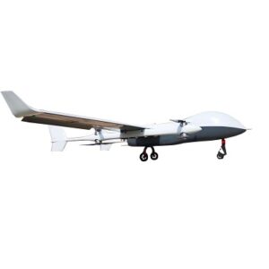
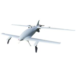
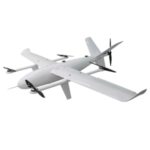
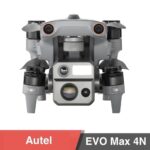
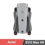
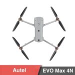
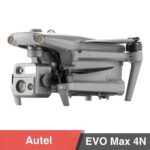
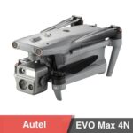
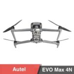
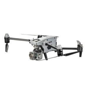
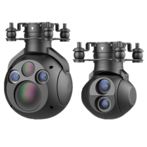
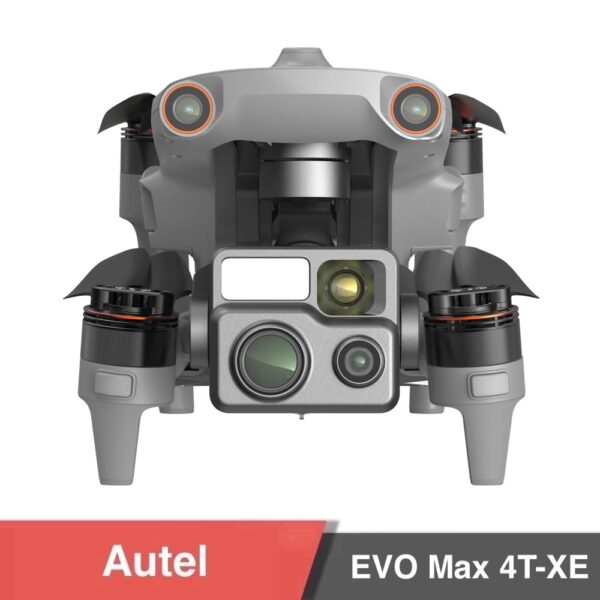
The Autel EVO Max 4N is a cutting-edge UAV platform designed for night-time missions, GPS-denied environments, and high-risk industrial inspections. With a powerful super-starlight night vision camera, integrated thermal imaging, laser rangefinder, and AI-powered tracking, this drone delivers unmatched autonomy, accuracy, and operational range—day or night.
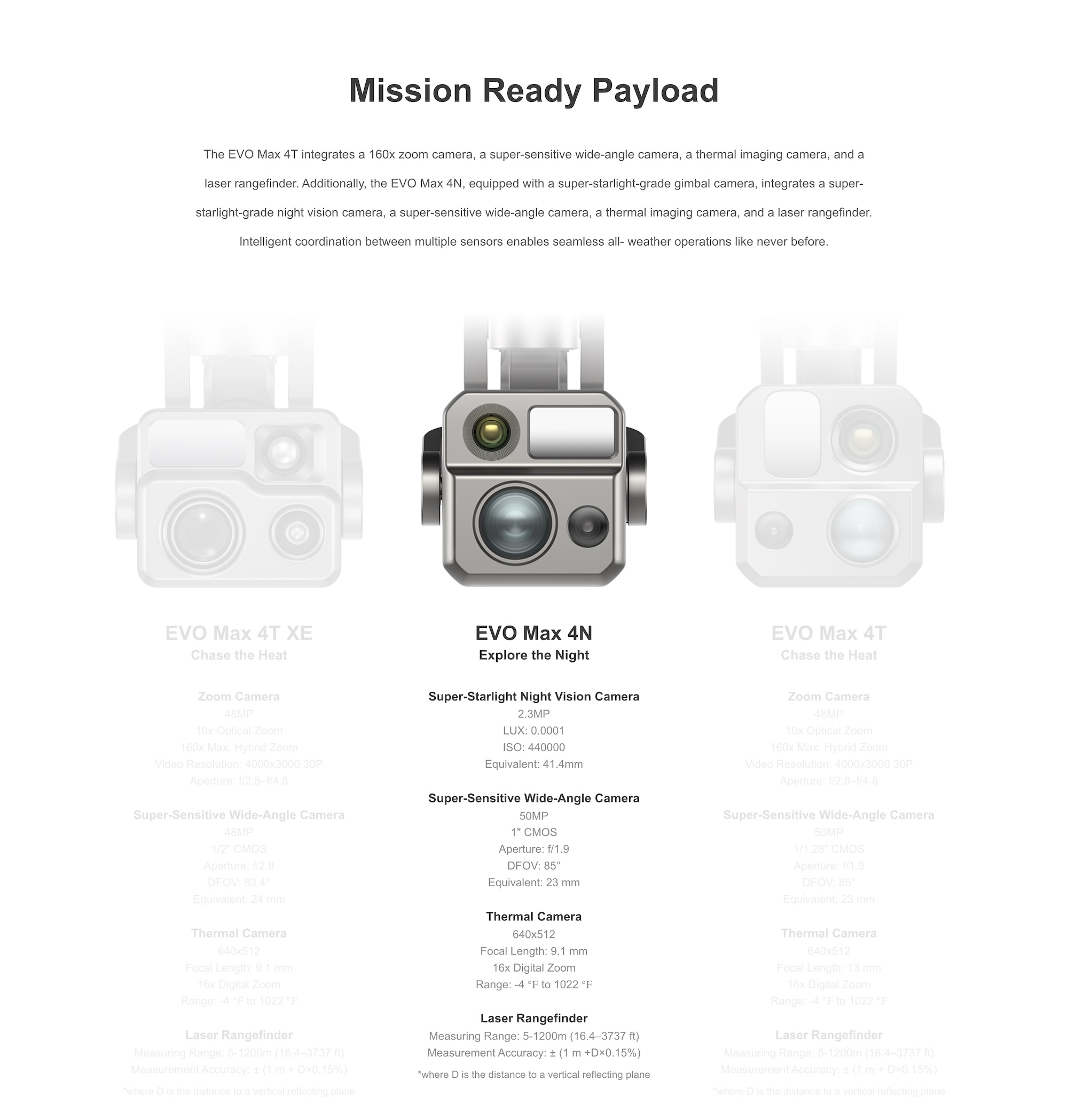
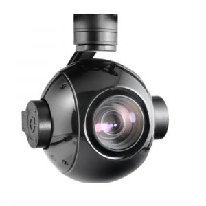
Multi-Sensor Gimbal Payload:
Super-Starlight Night Vision: 2.3MP, LUX: 0.0001, ISO: up to 450,000
50MP Wide-Angle EO Camera: 1″ CMOS, DFOV: 85°, f/1.9
640×512 Thermal Camera: 9.1mm lens, 16x digital zoom
Laser Rangefinder: Range 5–1200m, ±1m accuracy
AI Object Detection & Lock:
Automatically identifies and tracks people, vehicles, and heat signatures across EO and thermal feeds
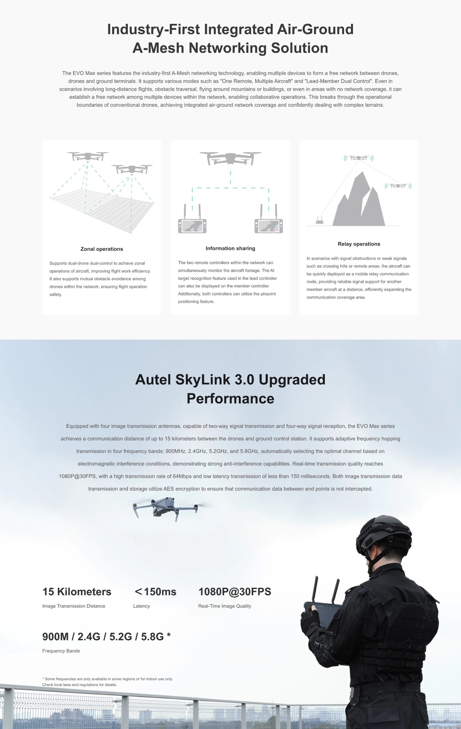
SkyLink 3.0 Transmission:
15km Range, 4-band frequency hopping (900M/2.4G/5.2G/5.8G), <150ms latency, 1080p @30fps, AES encrypted
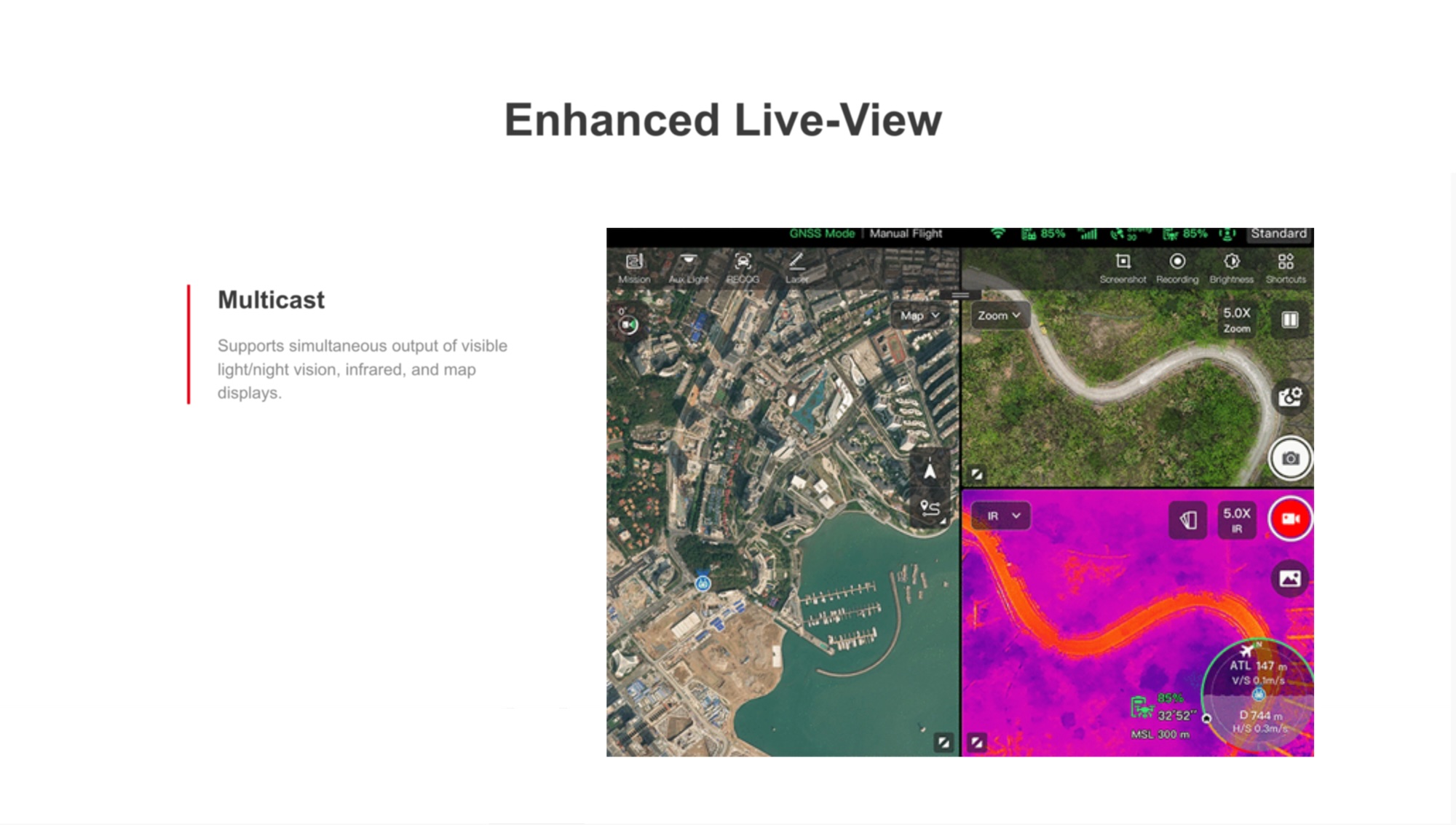
Multicast Live View:
Real-time simultaneous streaming of EO, thermal, and map views for enhanced situational awareness
SLAM-Powered Navigation:
Precise visual navigation when GNSS is denied or weak, using Simultaneous Localization and Mapping (SLAM)
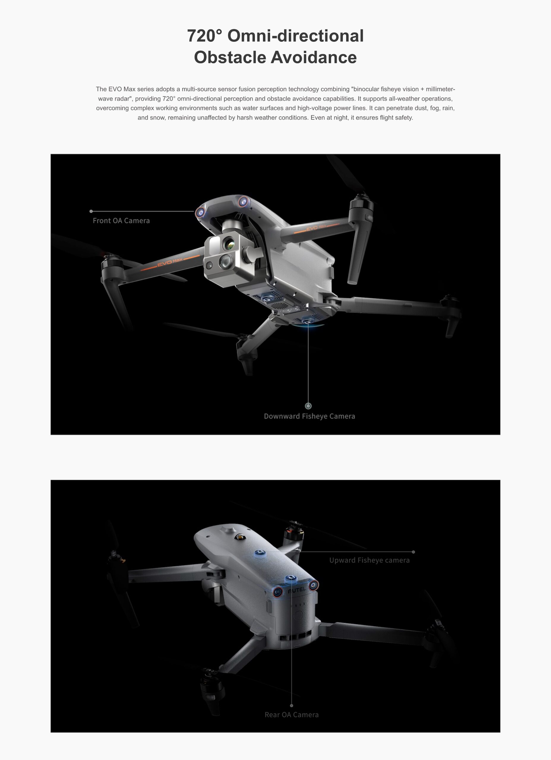
720° Omni-Directional Obstacle Avoidance:
Fisheye + mmWave radar sensors with front, rear, upward, and downward coverage
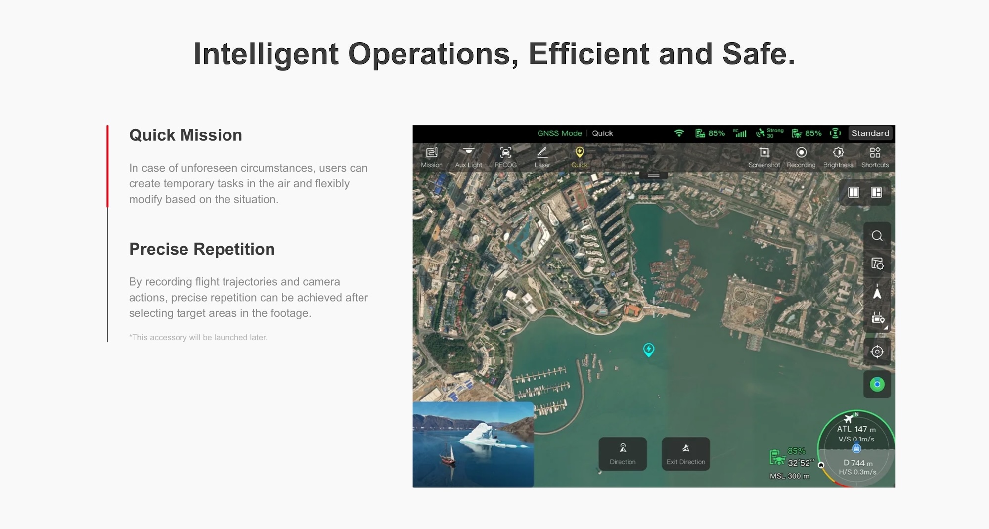
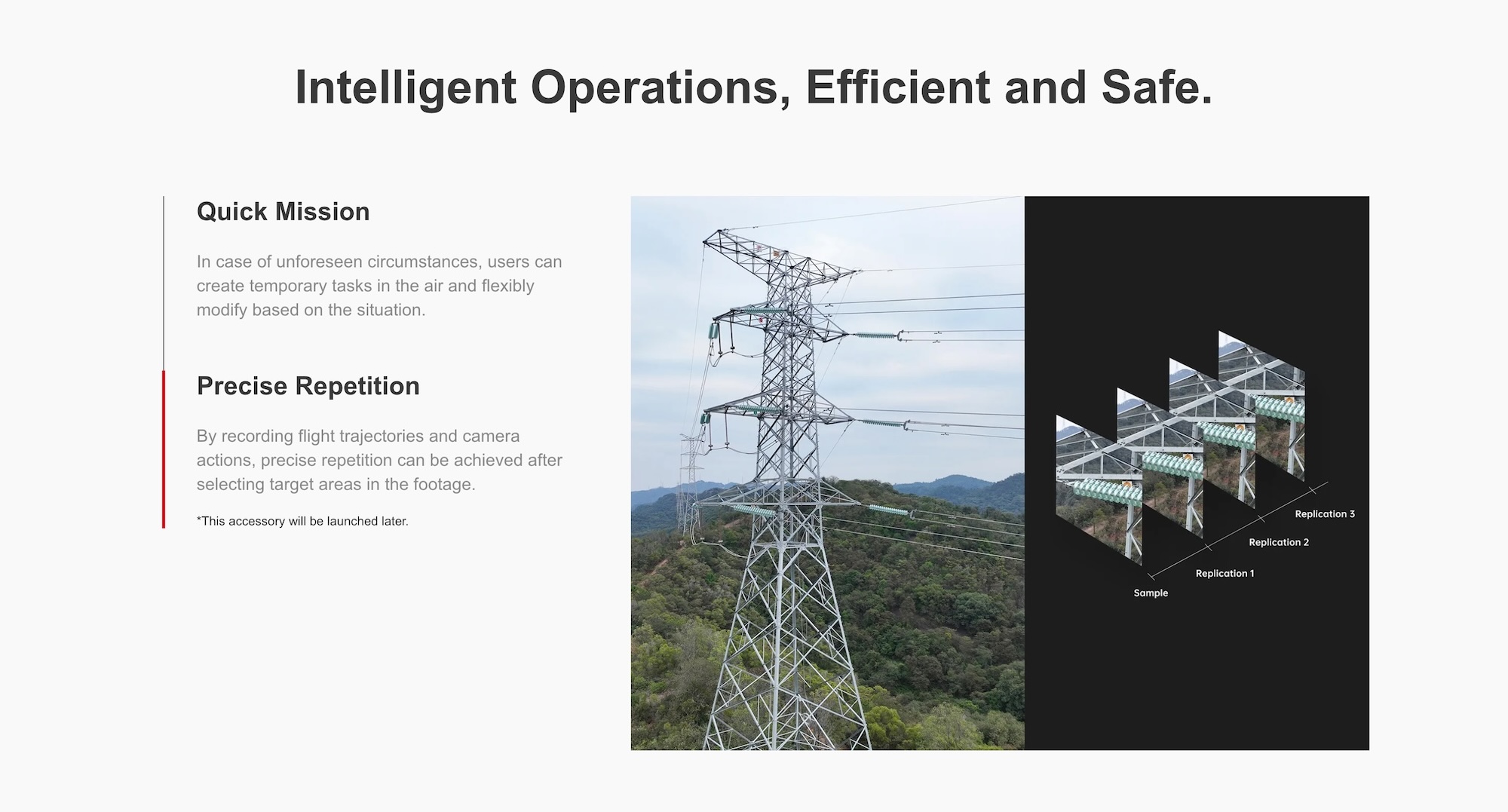
Autonomous Flight Modes:
3D scene reconstruction, obstacle avoidance, return-to-home
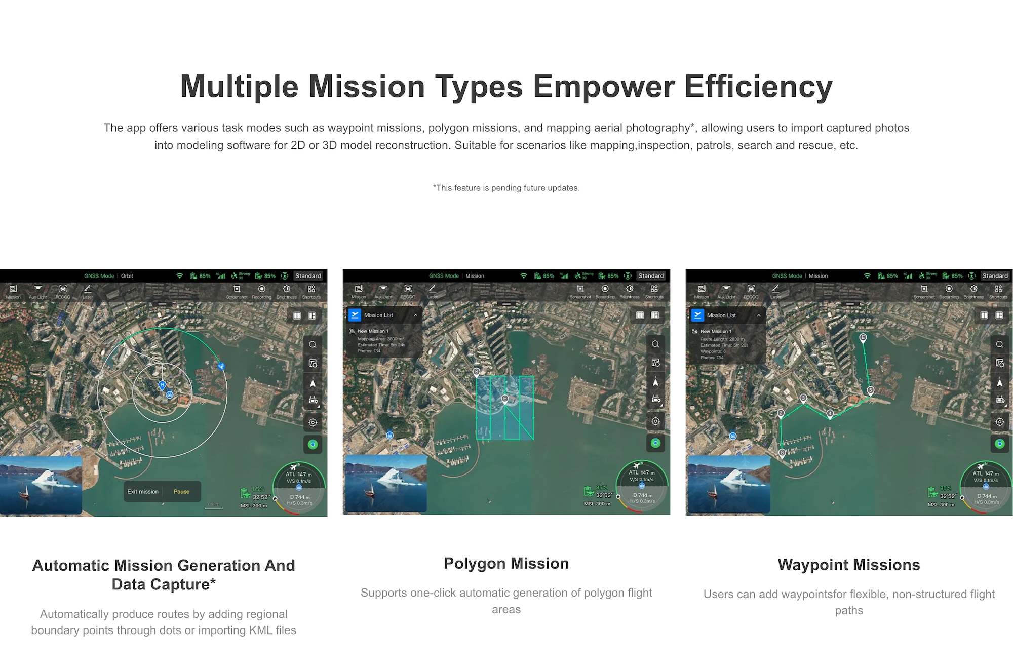
Polygon, Waypoint, and Quick Missions with Precise Repetition
Max Flight Time: 42 minutes
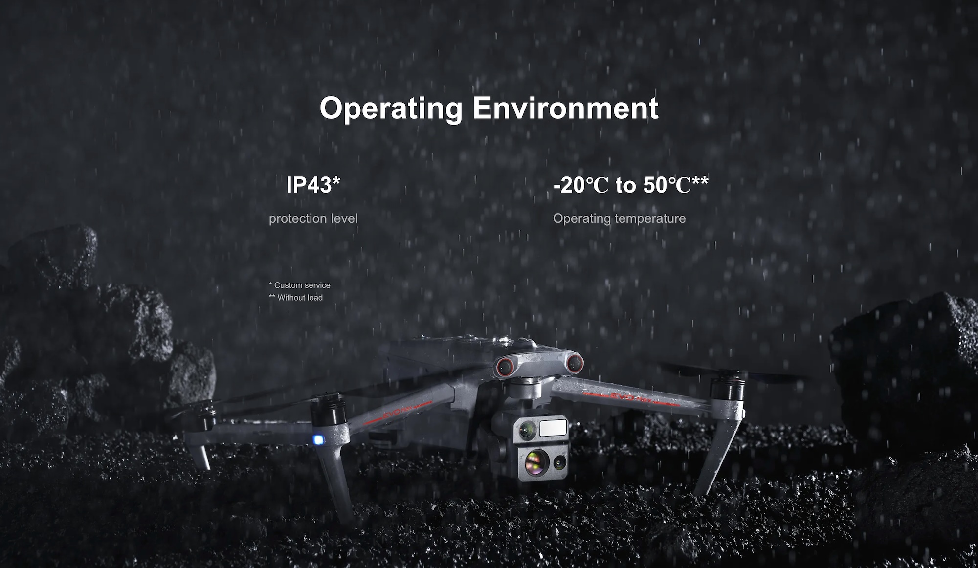
Operating Temp: -20°C to 50°C
Ingress Rating: IP43 (customizable)
A-Mesh 1.0 Air-Ground Network:
Connects multiple UAVs and GCS for zonal coverage, relay mode, and information sharing
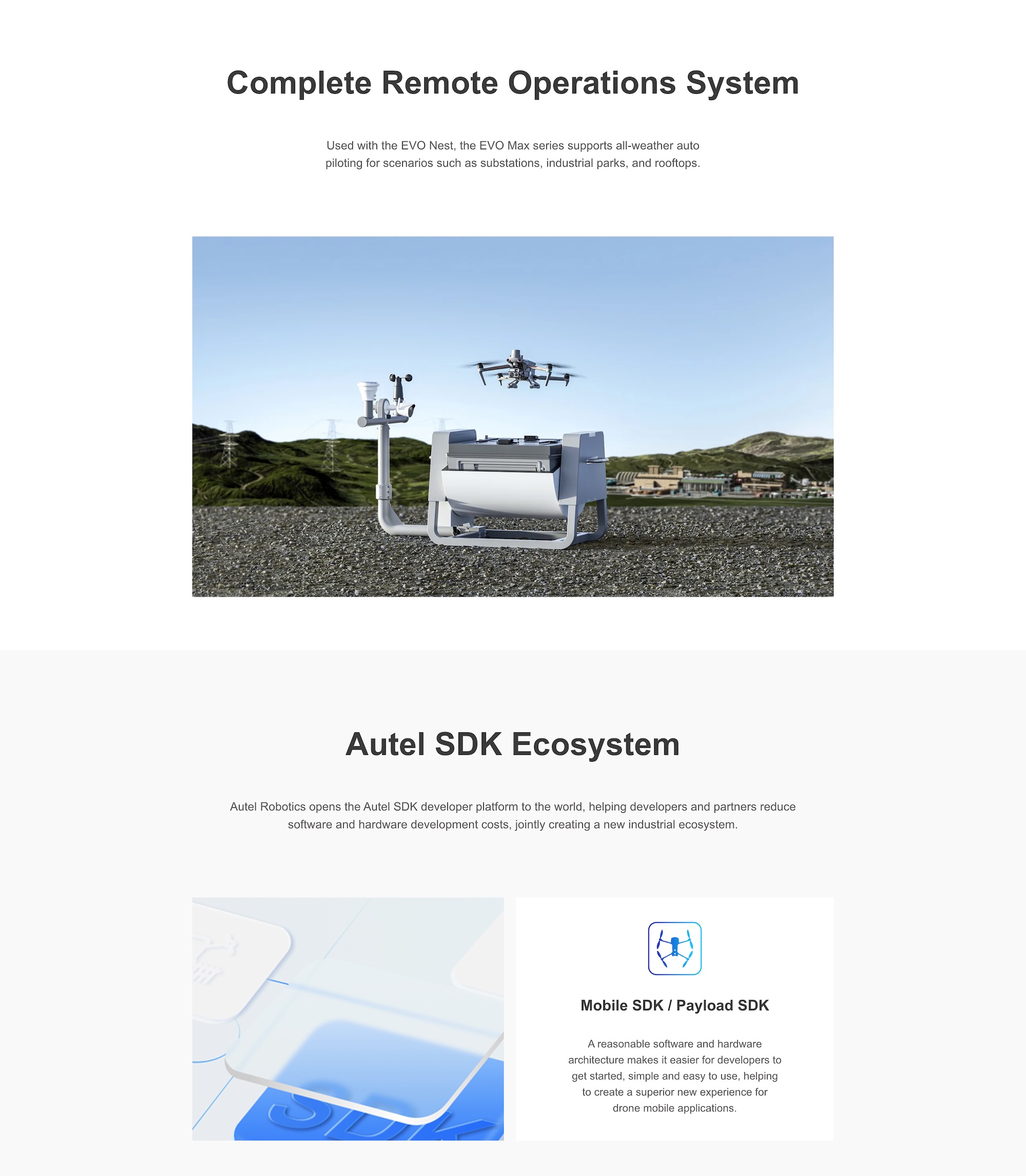
Autel SDK Ecosystem:
Supports Mobile SDK and Payload SDK for custom integrations and development
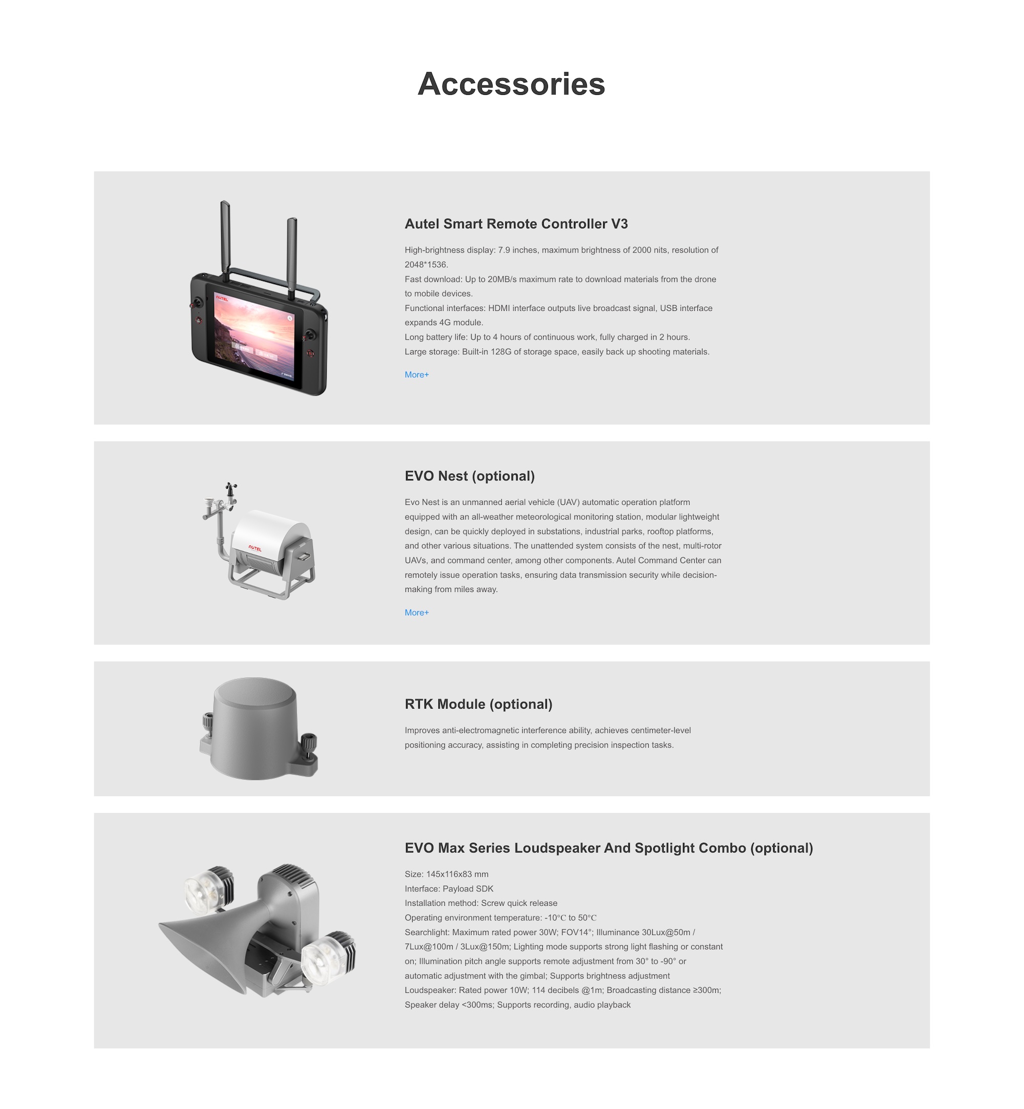
Remote Ops with EVO Nest (Optional):
Enables fully automated, weatherproof takeoff/landing for remote missions
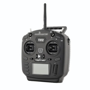
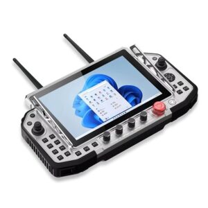
Smart Controller V3: 7.9″ display, HDMI out, 128GB storage
RTK Module (Optional): For centimeter-level accuracy in complex inspection tasks
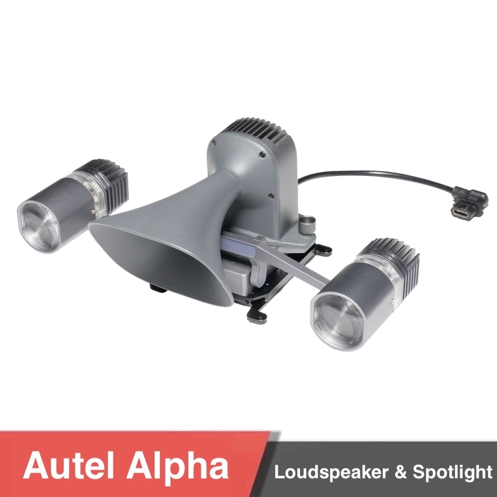
Spotlight & Loudspeaker Combo (Optional): 114 dB PA system with adjustable beam angle and flashing mode
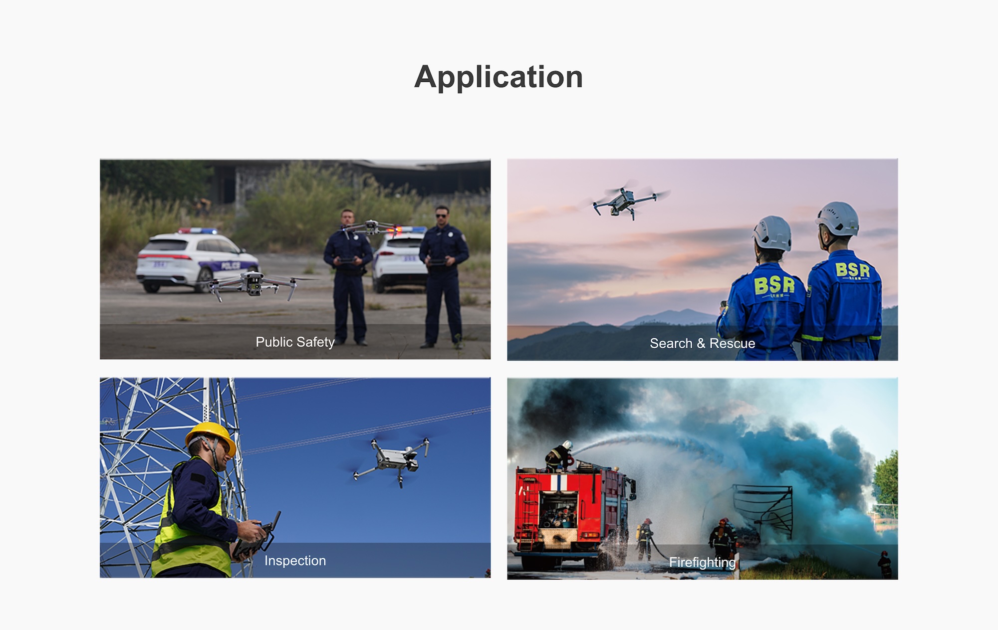
Public Safety – Patrol, surveillance, tactical support
Search & Rescue – Target tracking in night or thermal mode
Inspection – Power lines, infrastructure, telecom towers
Firefighting – Hotspot detection, incident response coordination

If you have any questions regarding our products, use the Motionew Contact us to consult our engineering team.
1. What are the key features of the Autel EVO Max 4N?
The EVO Max 4N is equipped with a starlight night-vision camera, 640×512 thermal imaging sensor, laser rangefinder, and wide-angle zoom lens, making it ideal for surveillance, search and rescue, and inspection tasks in low-light conditions.
2. What is the maximum flight performance?
It provides a 42-minute maximum flight time, 20 km image transmission range, and Level 8 wind resistance, ensuring stable operation in challenging environments.
3. What navigation and obstacle avoidance systems are included?
The drone features 360° obstacle avoidance with LiDAR and vision sensors, Autel’s A-Mesh networking, RTK positioning, and multi-GNSS (GPS, Galileo, BeiDou, GLONASS) compatibility for high-precision autonomous missions.
4. What payment options are available?
MotioNew supports major international credit/debit cards and bank wire transfers, processed through secure international gateways.
5. Does MotioNew provide OEM or customization services?
Yes. OEM branding, custom payload integration, and fleet configuration services are available for enterprise or government clients upon request.
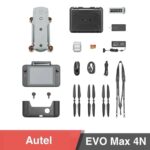
6. What documentation and accessories are included?
Each EVO Max 4N package includes a user manual, technical datasheet, RTK configuration guide, and a rugged transport case, along with access to firmware updates and dedicated after-sales support.

| EVO Max 4T Weight | 1645g (ABX40 Smart battery, Fusion 4T Gimbal, and propellers included) |
| EVO Max 4N Weight | 1665g (ABX40 Smart battery, Fusion 4N Gimbal, and propellers included) |
| EVO Max 4T XE | 1635g (ABX40 Smart battery, Fusion 4N Gimbal, and propellers included) |
| Maximum Take-off Mass | 1999g (4.41 lbs) |
| Maximum Take-off Mass (for C2 Certification in EU) |
1890g (4.17 lbs) |
| Fuselage Dimensions | 562*649*150 mm (unfolded, incl. 1136 propellers) 563*650*150 mm (unfolded, incl. 1158 propellers) |
| Diagonal Wheelbase | 465mm (1.53 ft) |
| Propeller Mode | 1136 (EOD) 1158 (Replacing 1136) |
| Propeller Size | 11 inch |
| Propeller weight | 1136: 10.8 g 1158: 10.3 g |
| Maximum Propeller Rotational Speed | 1136: 8000 RPM 1158: 7500 RPM |
| Maximum Ascent Speed | Slow: 2.5m/s Smooth: 3m/s Standard: 6m/s Ludicrous: 8m/s |
| Maximum Descent Speed | Slow: 2.5m/s Smooth: 3m/s Standard: 6m/s Ludicrous: 6m/s |
| Maximum Horizontal Flight Speed (Windless Near Sea Level) |
Slow: 3m/s Smooth: 10m/s Standard: 15m/s (forward & backward), 10m/s (sidewards) Ludicrous: 23m/s(forward), 18m/s(backward), 20m/s(sidewards) |
| Maximum Service Ceiling Above Sea Level | 4000 meters (13,123ft, use ABX40 smart battery) 3000 meters (9,843ft, use ABX41 smart battery) |
| Maximum Flight Altitude | Chinese Mainland or EU Laws: No more than 120 meters US Law: No more than 400 feet Note: The altitude can be set from 0 to 800 meters in the flight application Autel Enterprise. To set altitude higher than required by law, authority approval is required. |
| Maximum Flight Time (windless) | 42 min (Test data from lab with windless environment in the speed of 8 m/s during horizonal flight and only for reference) |
| Maximum Range | 25 km |
| Maximum Hovering Time | 38 min (Test data from lab with windless environment during hovering and only for reference) |
| Maximum Wind Speed Resistance | 12m/s (27mph) |
| Maximum Tilt Angle | Slow: 10° Smooth: 30° Standard: 30° Ludicrous: 36° |
| Maximum Angular Velocity | Pitch axis: 300°/s Heading axis: 120°/s |
| Operating Temperature | -20°C to 50°C (without load), -20°C to 40°C (full load) |
| Hot-swappable Batteries | Supported |
| IP Rating | IP43*(Custom service) |
| Internal Storage | 128GB internal storage, with 64GB of available space* (Remaining available space will vary with different firmware versions) |
| Strobe | Integrated |
| GNSS | GPS+Galileo+BeiDou+GLONASS |
| Hovering Accuracy | Vertically: ±0.1 m (when vision systems working normally) ±0.5 m (when GNSS working normally) Horizontally: ±0.3 m (when vision systems working normally) ±0.5 m (when GNSS working normally) |
| Wi-Fi Protocol | 802.11a/b/g/n/ac/ax |
| Wi-Fi Operating Frequency | 2.4G:2.400–2.476GHz*,2.400–2.4835GHz 5.2G:5.15-5.25GHz**,5.17-5.25GHz*** 5.8G:5.725-5.829GHz*,5.725-5.850GHz *Only applies to SRRC regions ** Only applies to FCC, CE (Germany excluded) and UKCA regions *** Only applies to Germany Note: Some frequencies are only applicable in some regions or only used in door. For details, please refer to local laws and regulations. |
| Wi-Fi Effective Isotropic Radiated Power (EIRP) | 2.4G: ≤30dBm (FCC/ISED); ≤20dBm (CE/SRRC/UKCA) 5.2G: ≤30dBm (FCC); ≤23dBm (CE/UKCA) 5.8G: ≤30dBm (FCC/ISED/SRRC); ≤14dBm (CE/UKCA) |
| Operating Frequency | 900M: 902-928MHz* 2.4G: 2.400–2.476GHz**, 2.400–2.4835GHz 5.2G: 5.15-5.25GHz***, 5.17-5.25GHz**** 5.8G: 5.725-5.829GHz**, 5.725-5.850GHz * Only applicable to FCC and ISED regions. ** Only applicable to SRRC regions. *** Only applicable to FCC, CE (Germany excluded) and UKCA regions **** Only applies to Germany Note: Some frequencies are only applicable in some regions or only used in door. For details, please refer to local laws and regulations. |
| Maximum Transmission Distance | FCC: 15km CE: 8km |
| Effective Isotropic Radiated Power (EIRP) | 900M: ≤30dBm (FCC/ISED) 2.4G: ≤30dBm (FCC/ISED); ≤20dBm (CE/SRRC/UKCA) 5.2G: ≤30dBm (FCC); ≤23 dBm (CE/UKCA) 5.8G: ≤30dBm(FCC/ISED/SRRC); ≤14dBm(CE/UKCA) |
| Image Sensor | 2.3M effective pixels |
| Lens | DFOV:52°±2° Effective Focal Length: 11.2 mm Aperture: F1.4 AF Motor: FF Focus: 10 m ~ ∞ |
| Zoom | 1 ~ 8x digital zoom. Linked zoom is supported. |
| ISO Range | Auto/Manual: ISO100 – ISO440000 Night Mode: ISO100 – ISO440000 (Auto) |
| Shutter Speed | Shooting: 8s ~ 1/10000s Recording: 1/30s ~ 1/10000s |
| Photo Size | 1920×1200 |
| Photo Format | JPG |
| Video Resolution | 1920×1200 P30 |
| Video Format | MP4 |
| Video Encoding | H.264/H.265 |
| Supported File Systems | exFAT/FAT32 |
| Image Sensor | 1/1.28″ CMOS. Effective pixels: 50M |
| Lens | DFOV: 85° Focal Length: 7 mm Equivalent Focal Length: 23 mm Aperture: F1.9 AF Motor: FF Focus: 0.5 m ~ ∞ |
| ISO Range | Auto/Manual: ISO100 – ISO6400 Night Mode: ISO100 – ISO32000 (auto) |
| Shutter Speed | Shooting: 8s ~ 1/10000s Recording: 1/30s ~ 1/10000s |
| Photo Size | 4000×3000, 8192×6144 |
| Photo Format | JPG |
| Video Resolution | 4000×3000 P30 |
| Video Format | MP4 |
| Video Encoding | H.264/H.265 |
| Supported File Systems | exFAT/FAT32 |
| Image Sensor | Uncooled VOx Microbolometer |
| Lens | FOV:61° Focal length:9.1mm Aperture: f/1.0 Focusing Distance:2.2m~∞ |
| Temperature Measurement Range | Center temperature measurement/Pot temperature measurement/Area temperature measurement |
| Radiometric Measurement Method | -20°C to 150°C (high gain mode) 0 to 550°C (low gain mode) |
| Radiometric Measurement Accuracy | ±2℃ or reading ±2% (using the larger value) @ambient temperature range from -4℉ to 140℉ (-20℃~60℃) |
| Accurate Temperature Measurement Distance | 1~25 m |
| Digital Zoom | 1-16x digital zoom, and link zoom supported |
| Temperature Alert | In area temperature measurement, high and low temperature alarm thresholds, reporting coordinates and temperature values are supported |
| Palette | White Hot/Black Hot/Ironbow/Rainbow 1/Rainbow 2/Lava/Arctic/Ironbow/Medical/Tint |
| Photo Size | 640×512 |
| Photo Format | JPG (the images contain temperature information and are parsed by dedicated SDK and PC tools) |
| Video Resolution | 640×512 P30 |
| Video Format | MP4 |
| Wavelength | 905 nm |
| Measurement Accuracy | ± (1 m + D×0.15%) where D is the distance to a vertical reflecting plane |
| Measuring Range | 5 – 1200 m |
| Mechanical Range | Pitch: -135° to 45° Roll: -50° to 50° Yaw: -45° to 45° |
| Controllable Range | Pitch: -90° to 30° |
| Stability System | 3-axis mechanical gimbal (pitch, roll, yaw) |
| Max Control Speed (Pitch) | 100°/s |
| Angular Vibration Range | <0.005°< /td> |
| Operating Frequency | 60G: 60 – 64 GHz 24G: 24.0 – 24.25 GHz |
| Effective Isotropic Radiated Power (EIRP) | 60G: ≤20dBm (CE/UKCA/FCC) 24G: ≤20mW (SRRC) |
| Sensing Range | 60G millimeter-wave radar: Upward: 0.3 – 20 m Downward: 0.15 – 80 m Forward & Backward: 0.3 – 50 m 24G millimeter-wave radar: Downward: 0.8 – 12 m |
| FOV | Horizontal (6dB): ±60°/±22° (60 GHz/24 GHz) Vertical (6dB): ±30°/±20° (60 GHz/24 GHz) |
| Operating Environment | 60 GHz millimeter-wave radar sensing system: Supports all-weather obstacle avoidance for glass, water, wires, buildings, and trees in 4 directions. Its obstacle avoidance distance varies with the obstacle’s ability to reflect electromagnetic waves and its surface size. 24 GHz millimeter-wave radar sensing system: Supports downward sensing, and its sensing range varies by the ground material. For example, the sensing range of cement ground is 12 meters, and the sensing range of grass with a thickness of more than 3 cm is less than 6 meters. |
| Aircraft Version Limitations* | To comply with (national) regional regulations, certain aircraft versions use a 24 GHz millimeter-wave radar in the downward direction and use 60 GHz radars in the forward, backward, and upward directions. In the 24 GHz aircraft version, the 60GHz radars in the forward, backward, and upward directions are disabled in the flight software at the factory, and only the 24GHz radar in the downward direction is enabled to assist in landing. The 24 GHz aircraft version only supports visual obstacle avoidance under good lighting conditions and does not support millimeter-wave radar obstacle avoidance at night. |
| Sensing Range | Forward: 19.7-1220.5in (0.5-31m) Backward: 19.7-984.3in (0.5-25m) Sideward: 19.7-1023.6in (0.5-26m) Upward: 0.66-85.3ft (0.2-26m) Downward: 0.98-75.5ft (0.3-23m) |
| FOV | Forward/Backward Sensor: 60°(H), 80°(V) Upward/Downward Sensor: 180°(sideward), 120°(forward & backward) |
| Operating Environment | Forward, backward, sideward, and upward: The surface has rich texture, under a sufficient lighting environment (>15 lux, normal indoor fluorescent lighting environment) Downward: The surface is a diffuse material with a reflectivity >20% (walls, trees, humans, etc.), under sufficient lighting environment (>15 lux, normal indoor fluorescent lighting environment) |
| Sensing Range | Forward & Backward: 0.3 – 50 m Sidewards: 0.5 – 26 m Upward: 0.2 – 26 m Downward: 0.15 – 80 m (60GHz millimeter-wave radar) |
| FOV | Forward & Backward: 120°(H), 80°(V) Upward: 180° (sidewards), 120° (forward & backward) Downward: 180° (sidewards), 120° (forward & backward) |
| Operating Environment | Forward, backward, upward, and downward: Supports all-weather obstacle avoidance for various conditions, including water, forests, buildings and high voltage lines. At least one of the two conditions should be met: sufficient lighting or the obstacle has a strong reflection ability to electromagnetic waves. Sidewards: The surface has rich textures, under a sufficient lighting environment (>15 lux, normal indoor fluorescent lighting environment). |
| Dimensions | 269×189×87 mm (antennas folded, sticks and bracket included) 269×189×173 mm (antennas vertical to screen, sticks and bracket included) 269×302×87 mm (antennas unfolded, sticks and bracket included) |
| Weight | 1194 g (protective case excluded) 1365 g (protective case included) |
| Operating Temperature | -20°C to 40°C |
| Protection Rating | IP43 |
| Display | Dimensions: 7.9 inches Maximum Brightness: 2000 nits Resolution: 2048×1536 Refresh Rate: 60Hz Touch Control: Supports 10-point touch |
| Battery | Battery Type: Li-Po 3S Rated Capacity: 5800mAh Voltage: 11.55V Battery Energy: 67Wh Charing time: 120 min Battery Endurance: 2.5 hours (Max brightness), 4.0 hours (50% brightness) |
| Maximum Transmission Distance (Without Interference and Blocking) |
FCC: 15km (9.3 miles) CE / SRRC: 8km (4.9 miles) |
| IP Rating | IP43 |
| Internal Storage | 128G |
| GNSS | GPS+GLONASS+Galileo+Beidou |
| Operating Temperature | -4°F to 104°F (-20℃ to 40℃) |
| Wi-Fi Protocol | 802.11a/b/g/n/ac Support 2 x 2 MIMO Wi-Fi |
| Wi-Fi Operating Frequency | 2.4G: 2.400–2.476GHz*, 2.400–2.4835GHz 5.8G: 5.725-5.829GHz*, 5.725-5.850GHz *Only applies to SRRC region Note: Some frequencies are only applicable in some regions or only used in door. For details, please refer to local laws and regulations. |
| Wi-Fi Effective Isotropic Radiated Power (EIRP) | 2.4G: ≤30dBm(FCC/ISED); ≤20dBm(CE/SRRC/UKCA) 5.8G: ≤30dBm(FCC/ISED/SRRC); ≤14dBm(CE/UKCA) |
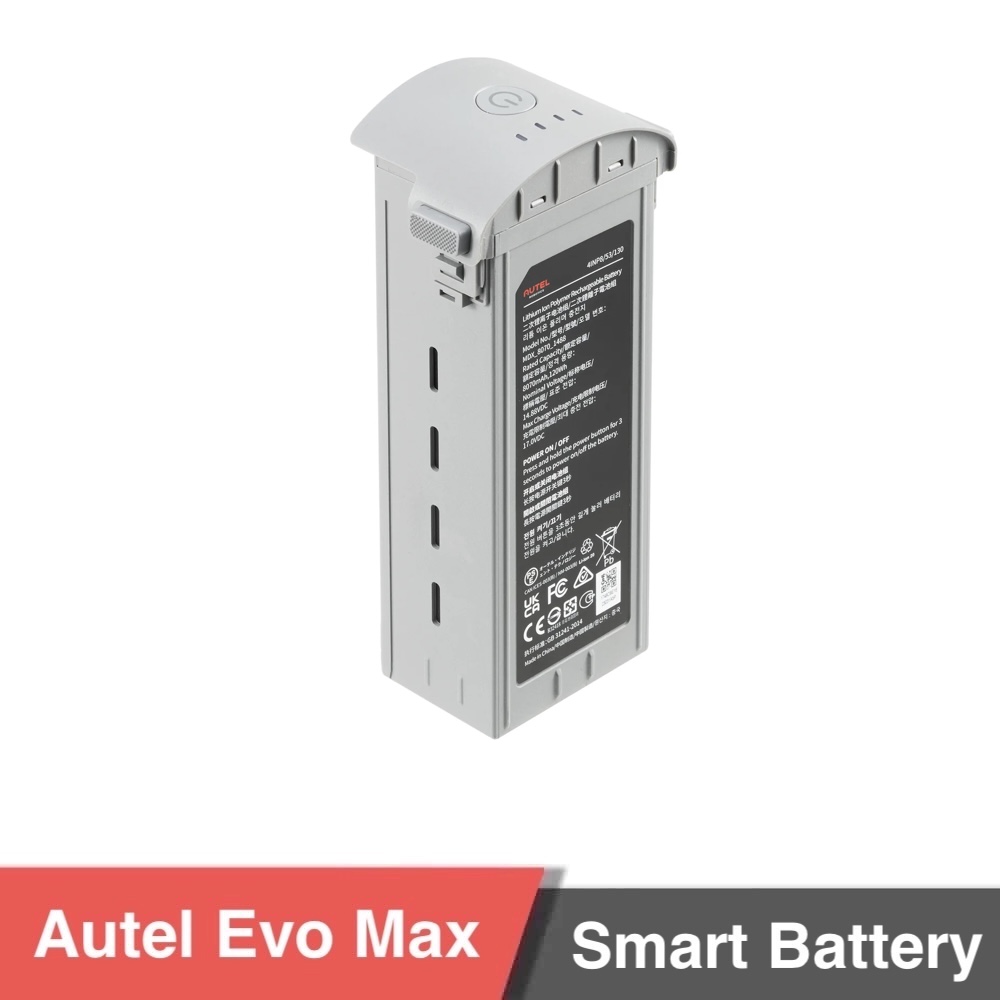
| Battery Dimension | 158.4×74.3×50.7 mm |
| Operating Temperature | -4° F to 113° F (-20°C to 50°C) |
| Battery Type | LiPo 4S |
| Rated Capacity | ABX40: 8070mAh ABX41: 9248mAh |
| Voltage | ABX40: 14.88V ABX41: 14.76V |
| Battery Energy | ABX40: 120Wh ABX41: 136.5Wh |
| Weight | ABX40: 1.15 lbs (520g) ABX41: 1.17 lbs (533g) |
| Battery Charge Temperature | 41° F to 113° F (5ºC to 45ºC) (When the battery temperature is below +5°C, the battery stops charging and activates self-heating. When the battery temperature is above +45°C, the battery stops charging.) |
| Hot Swappable | Supported |
You must be logged in to post a review.
| MTOW |
2kg |
|---|---|
| Max. Payload |
0.33kg |
| Multirotor Application |
Inspection/Surveillance ,Mapping |
| Multirotor Wheelbase |
465mm |
| Number of motors |
4 |
| Number of arms |
4 |
| Airframe Weight |
1.6kg |
| Foldable Airframe |
YES |
| Multirotor Type |
Electric |
No account yet?
Create an Account

Reviews
Clear filtersThere are no reviews yet.