This product requires export license. MotioNew can apply for export license for this product for your company. Please contact us for more information before purchasing. Original price was: 18,900.00 $.14,659.00 $Current price is: 14,659.00 $. Payment Methods:
-22%


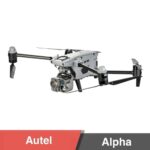
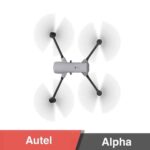
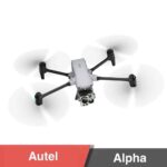
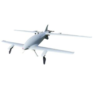
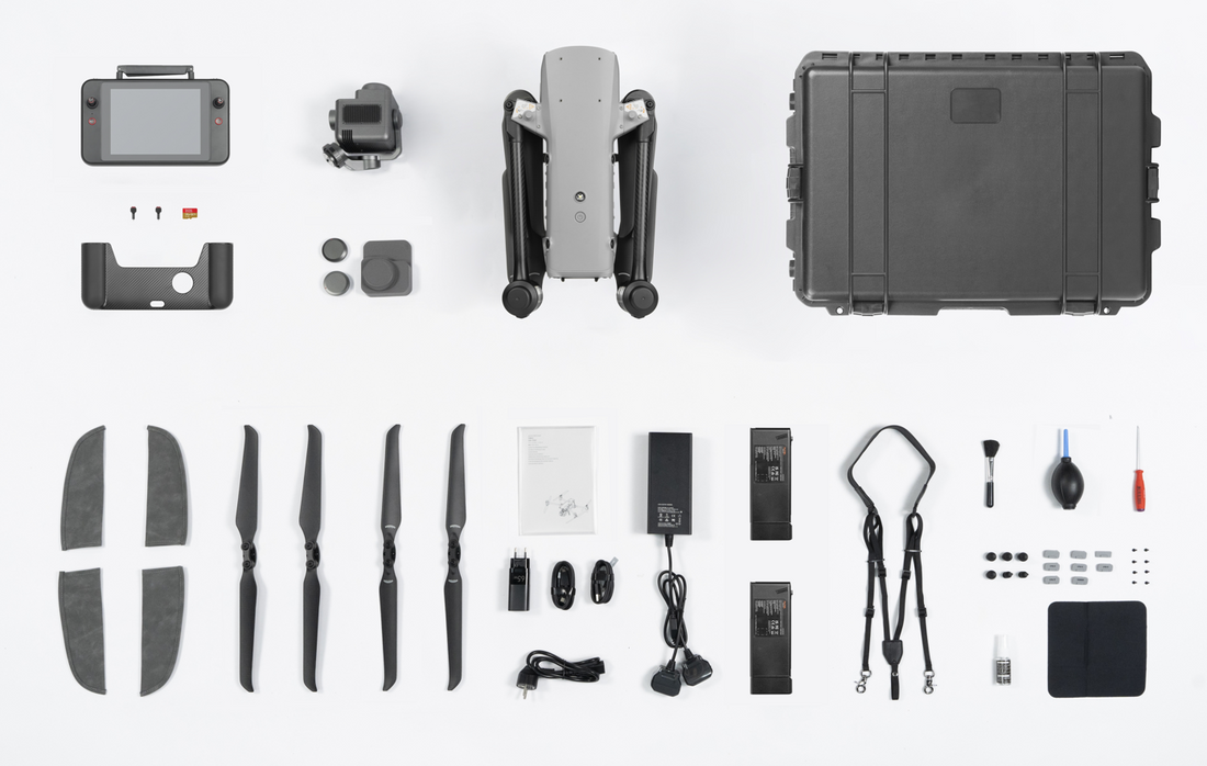
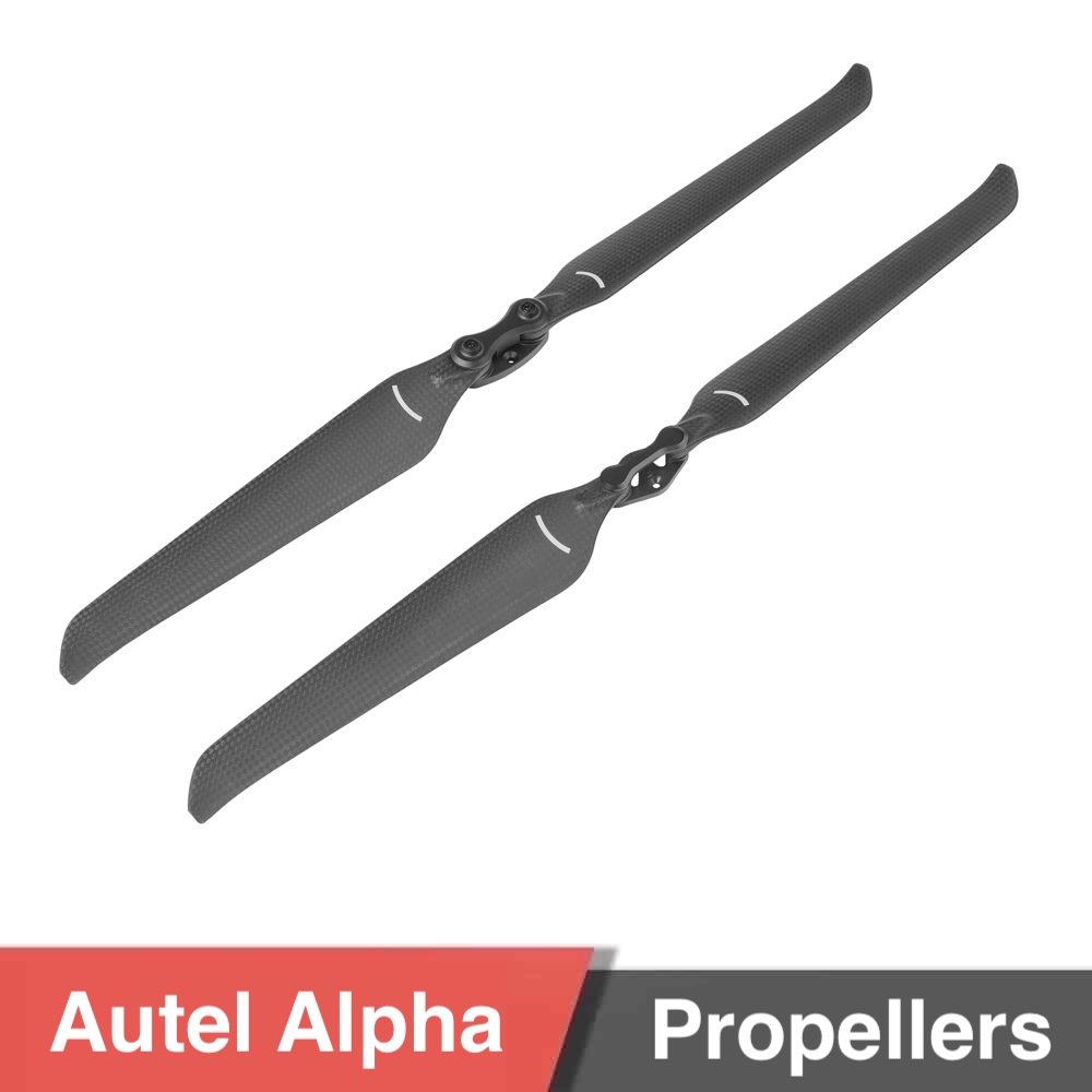
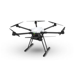
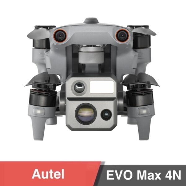
Autel Alpha
![]()
Important Notice!
If your company intends to export UAV products from China, it is necessary to comply with Chinese regulations. MotioNew products cannot be used for military, terrorist, or war purposes. Please read our Terms of Service for more information.
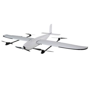
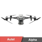
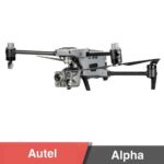
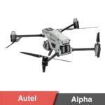
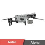
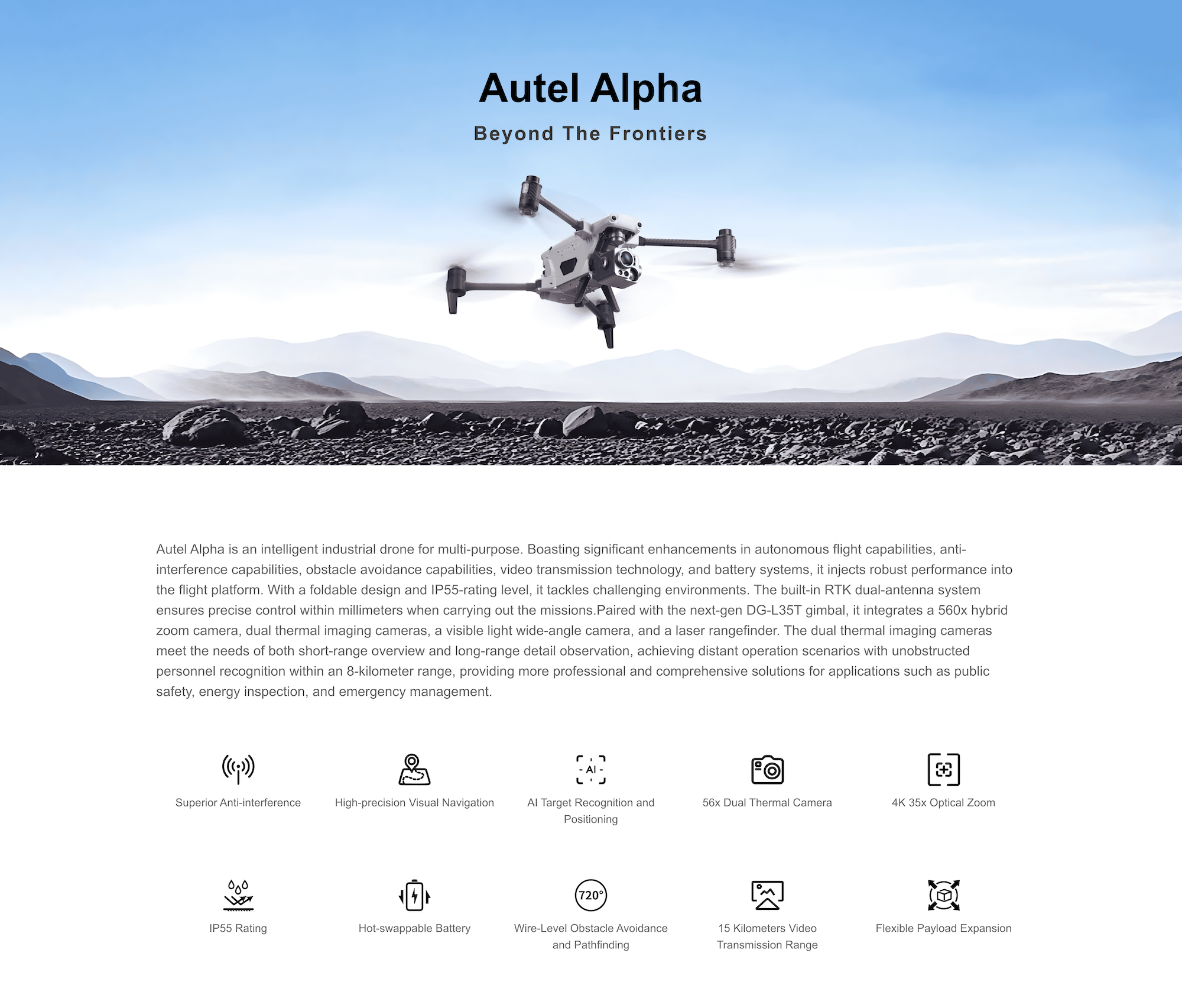
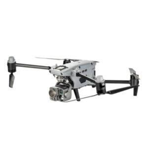
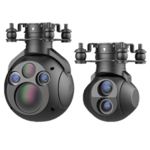
Autel Alpha is a next-generation intelligent drone engineered for demanding multi-purpose operations. Built with exceptional flight autonomy, enhanced anti-interference capability, and industry-grade imaging payloads, Alpha delivers precision performance in complex environments like powerlines, industrial zones, and emergency response sites.
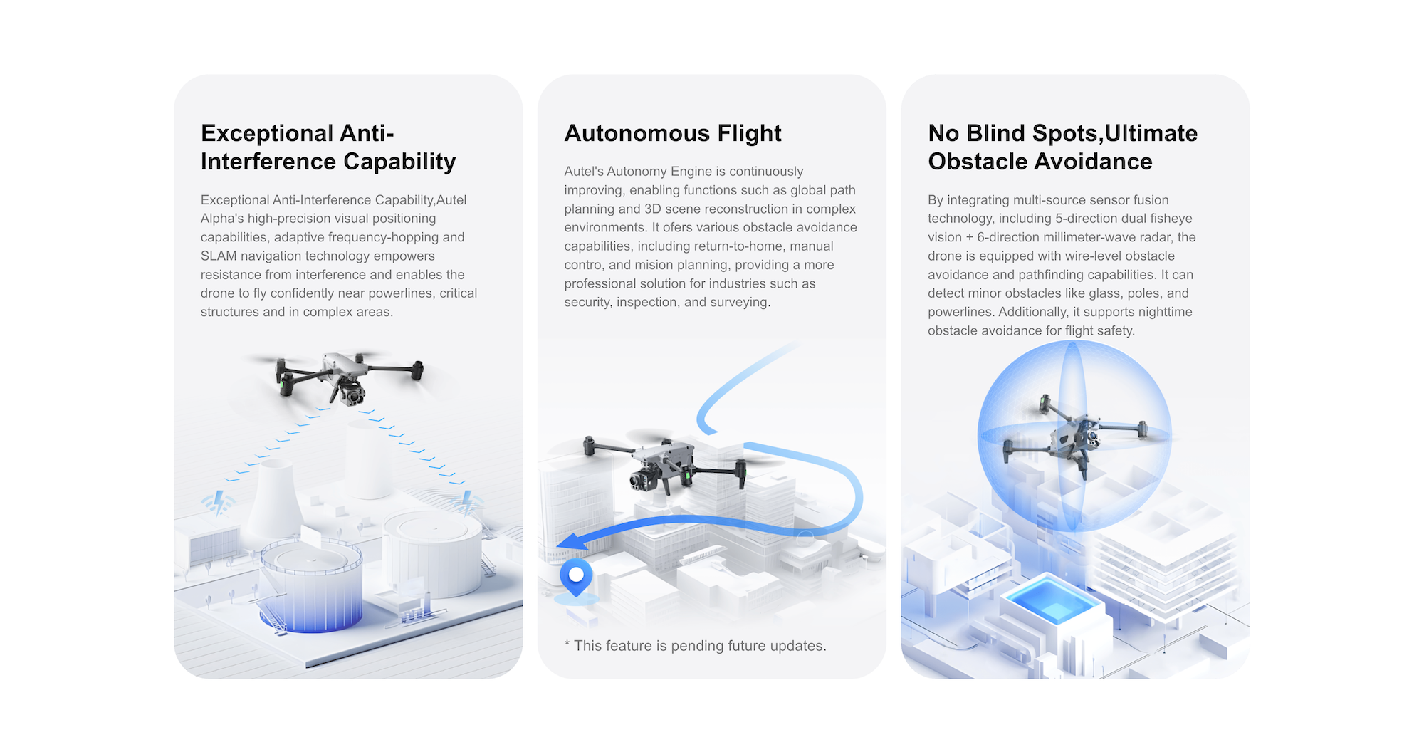
Stay connected in complex environments with dual-antenna RTK positioning, SLAM navigation, and adaptive frequency-hopping. The Alpha is engineered for stable, interference-free operations, even near high-voltage lines or urban RF congestion.
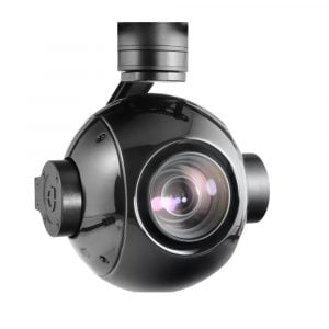
4K 35× Optical Zoom (up to 560× hybrid zoom) for ultra-clear visuals at 8 km recognition range
Dual 56× Zoom Thermal Cameras (13mm & 45mm lenses) for short and long-range thermal imaging
Wide-Angle 48MP Camera for high-resolution mapping and documentation
Laser Rangefinder with ±1m accuracy up to 2 km
Perfect for detailed inspections, search & rescue, and precision mapping.
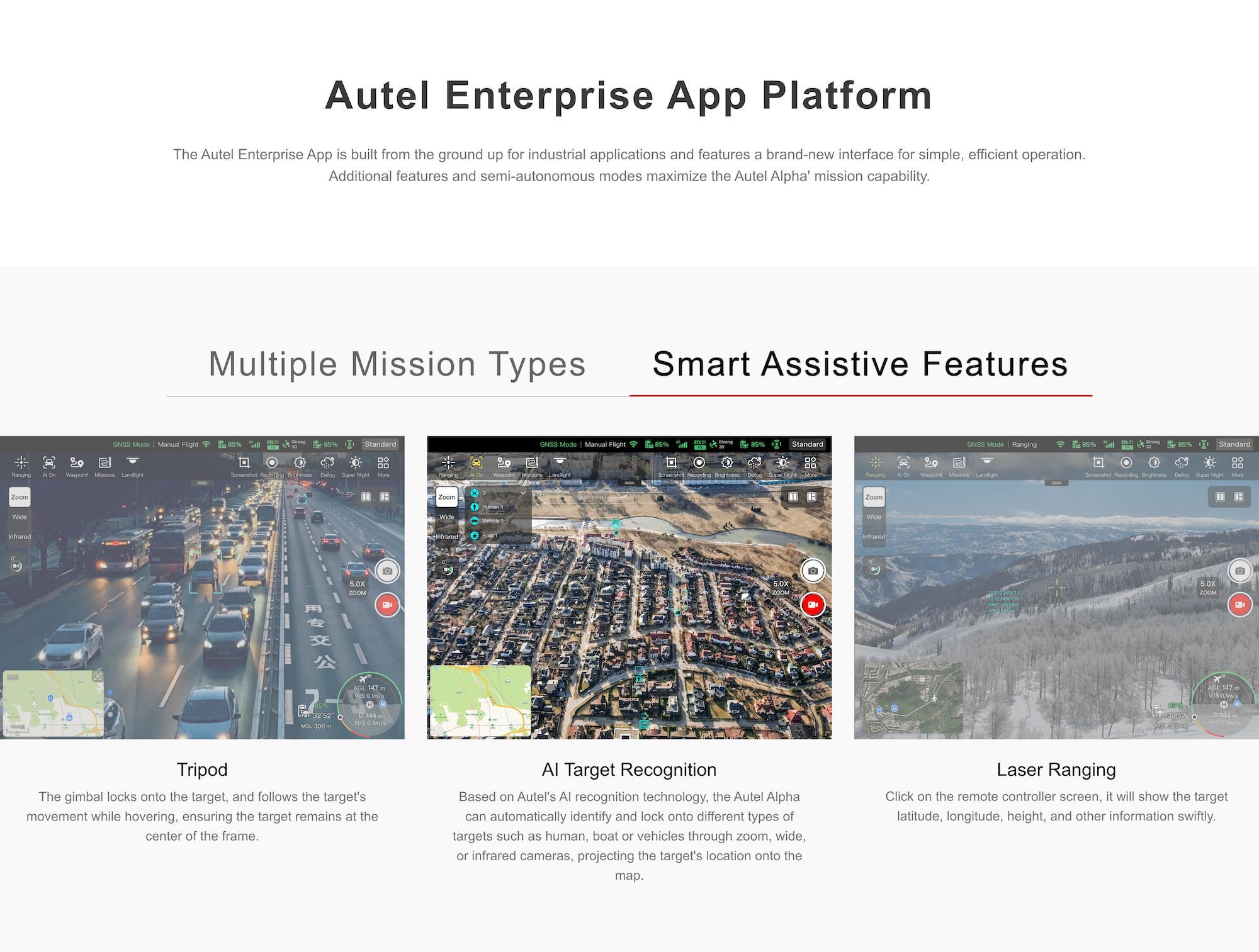
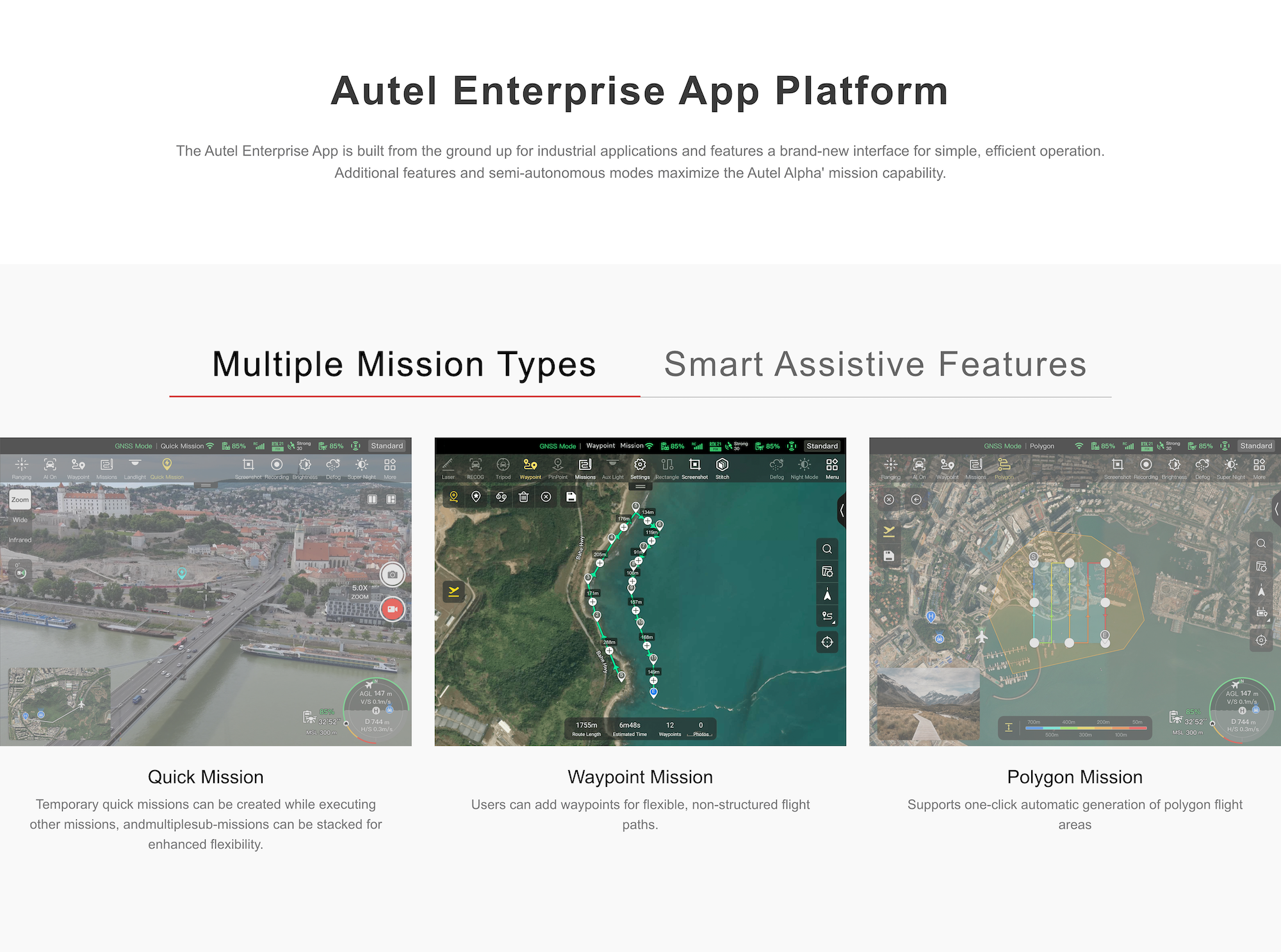
With the Autel Autonomy Engine, the Alpha executes:
Real-time 3D scene reconstruction
Multi-point return-to-home
SLAM-based indoor/outdoor navigation
AI recognition and live tracking of vehicles, people, and objects
Automated waypoint, polygon, and tripod missions
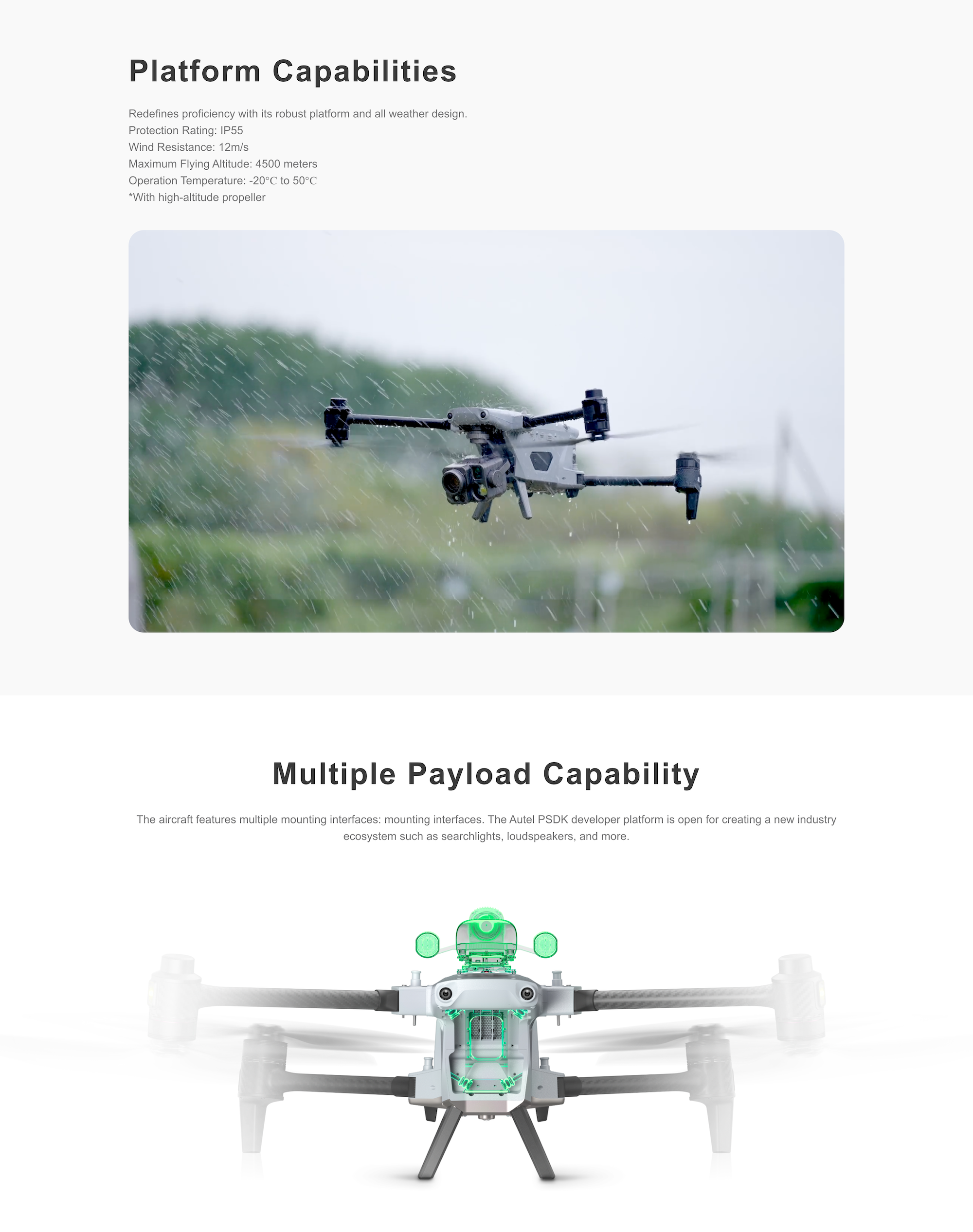
IP55 rating – dustproof, rainproof, wind-resistant (up to 12 m/s)
Operates from -20°C to 50°C
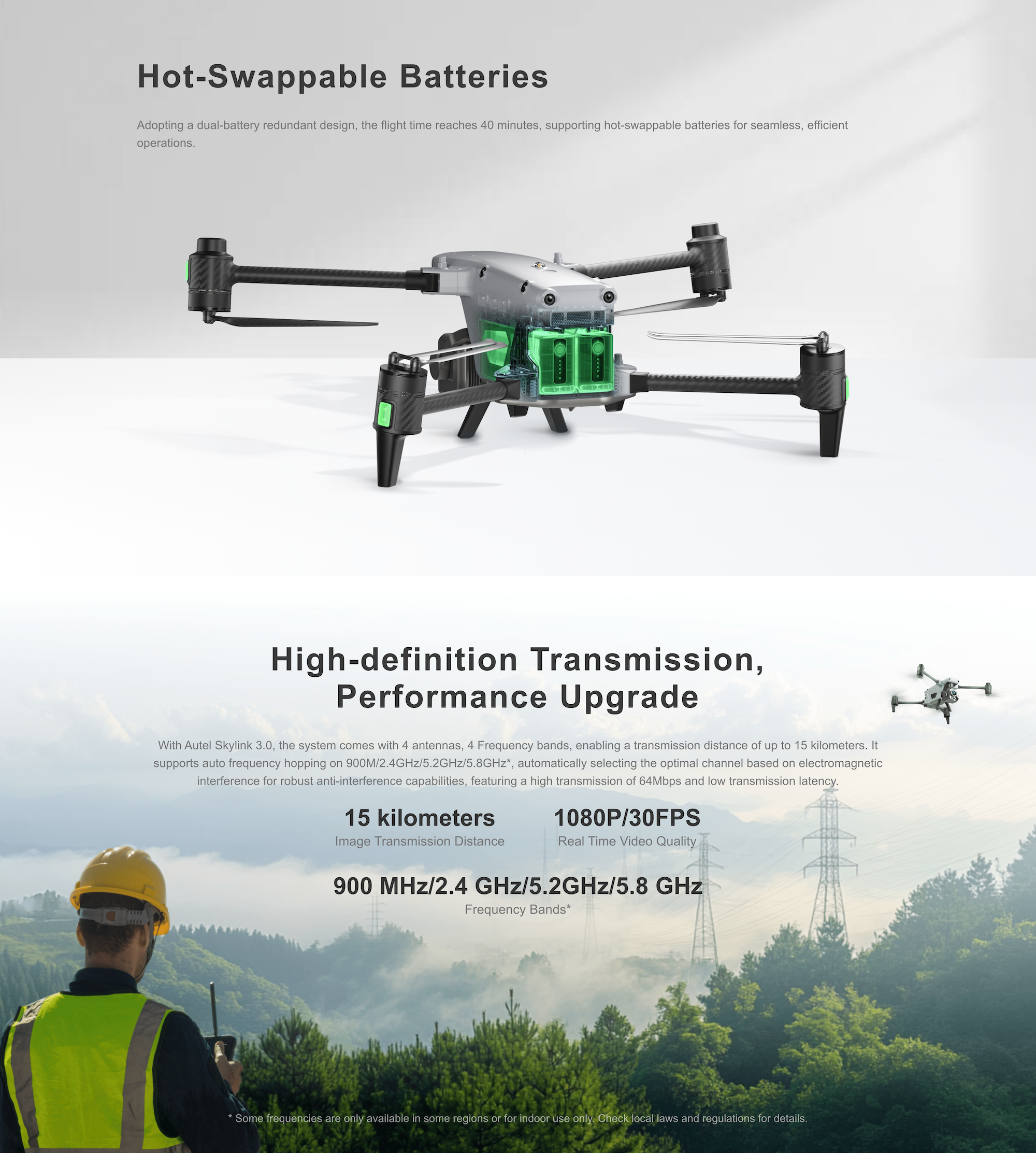
Hot-swappable dual batteries – up to 40 minutes of flight per set
15 km range with SkyLink 3.0
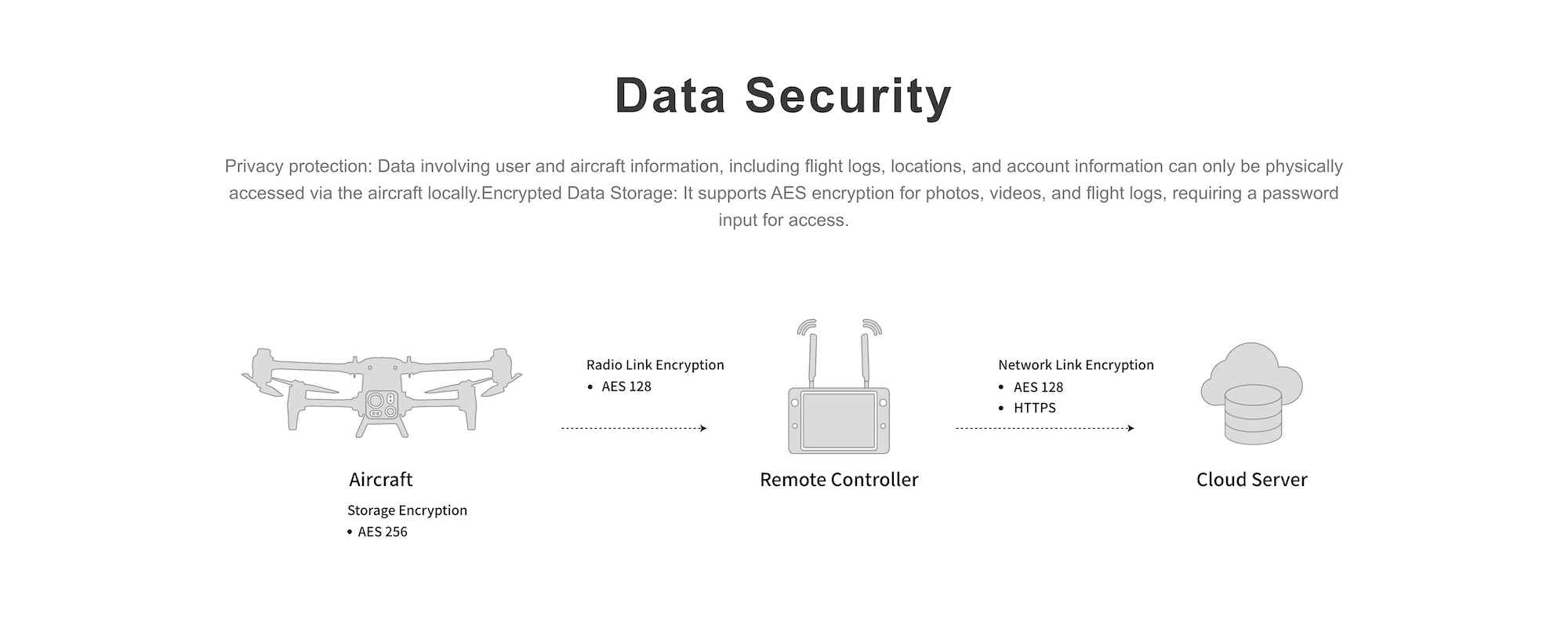
1080p@30fps, 4-band AES-encrypted link for secure data transfer
| Feature | Specification |
|---|---|
| Max Flight Time | 40 min (dual batteries) |
| Max Transmission Range | 15 km (1080p) |
| Zoom Camera | 8MP, 35× optical, 560× hybrid |
| Thermal Cameras | 640×512, 13mm & 45mm |
| Wide Camera | 48MP, 84° FOV |
| Laser Rangefinder | 10–2000m, ±1m accuracy |
| Protection Rating | IP55 |
| Operating Temperature | -20°C to 50°C |
| Max Altitude | 4500 m |
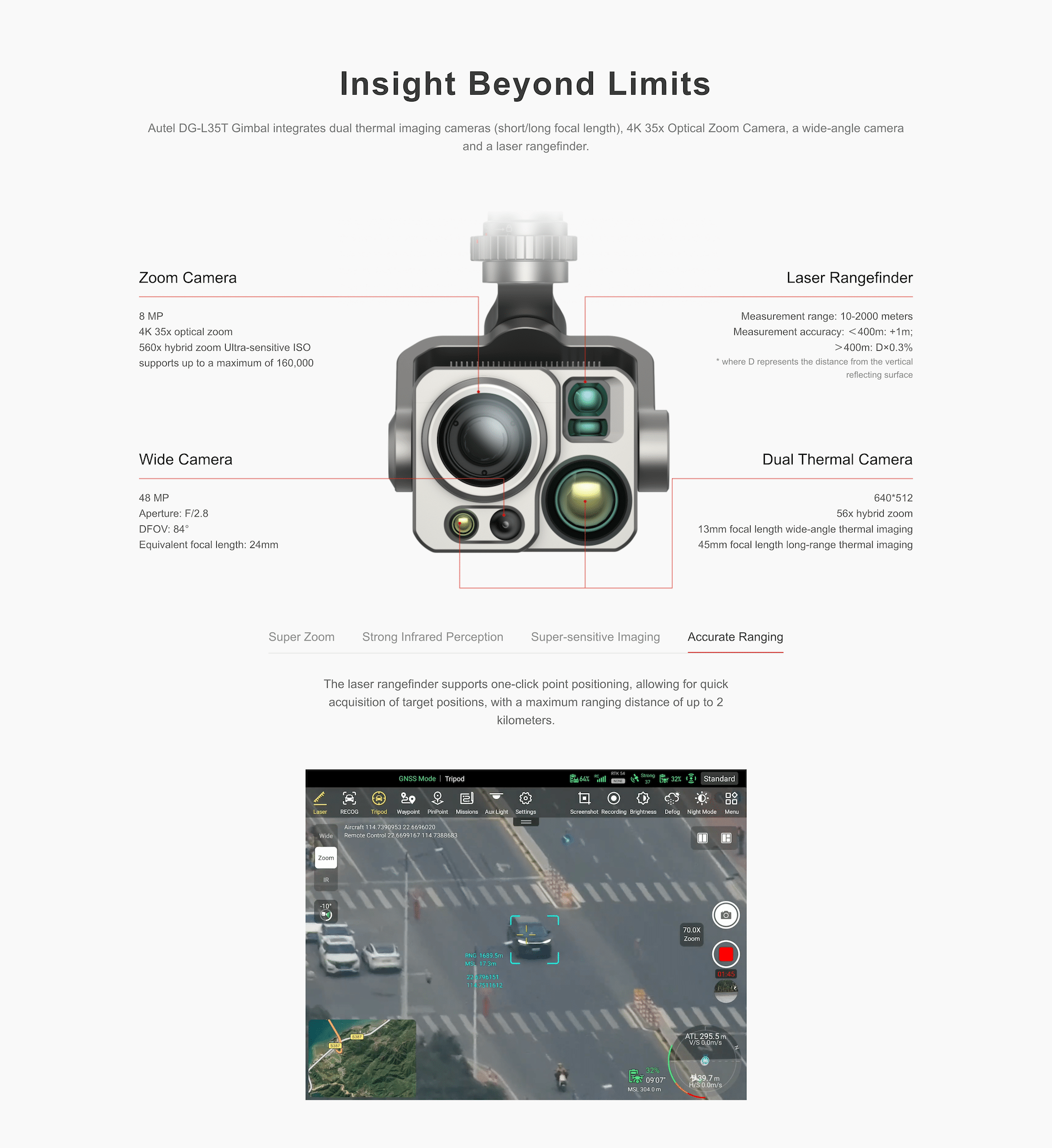
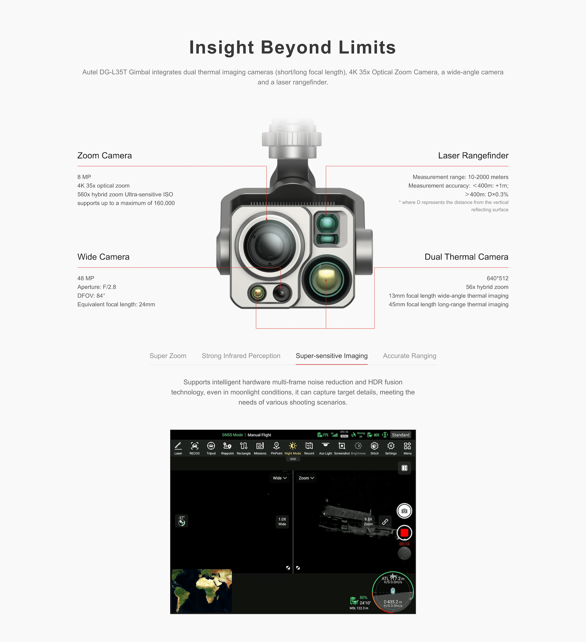
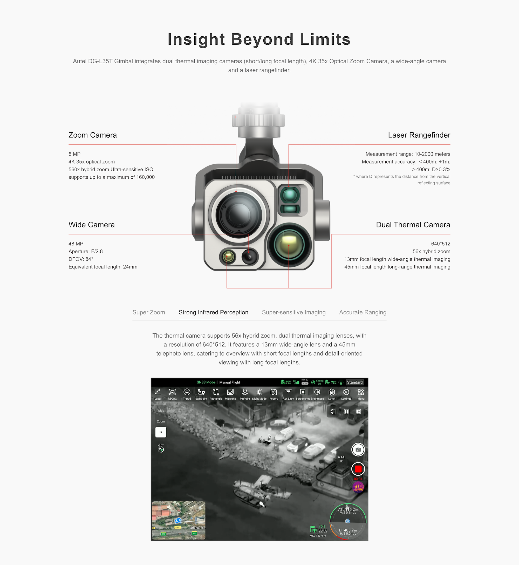
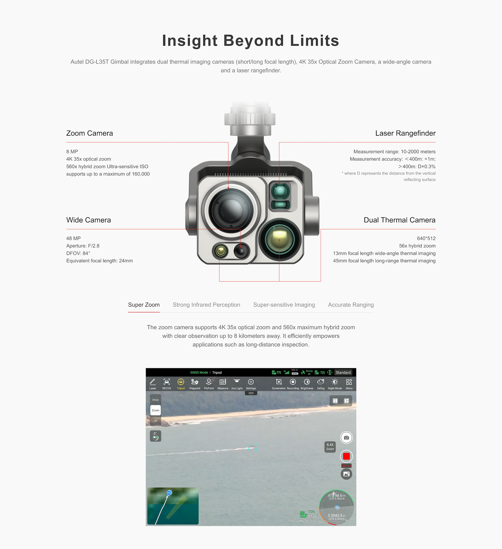
Insight Beyond Limits
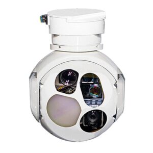
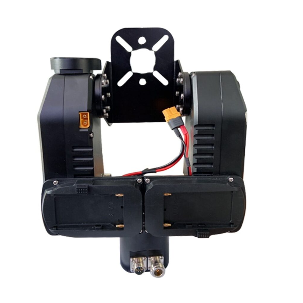
The integrated DG-L35T gimbal brings four high-performance sensors together:
Zoom Camera: 8MP, 4K 35× optical, 560× hybrid zoom, ISO up to 160,000
Dual Thermal Cameras: 640×512, 13mm & 45mm lenses
Wide Camera: 48MP, 24mm equivalent, F2.8
Laser Rangefinder: 10–2000m, ±1m or 0.3% error
These sensors enable super zoom, infrared imaging, nighttime clarity, and millimeter-level distance targeting — ideal for search and rescue, inspection, and precision mapping.
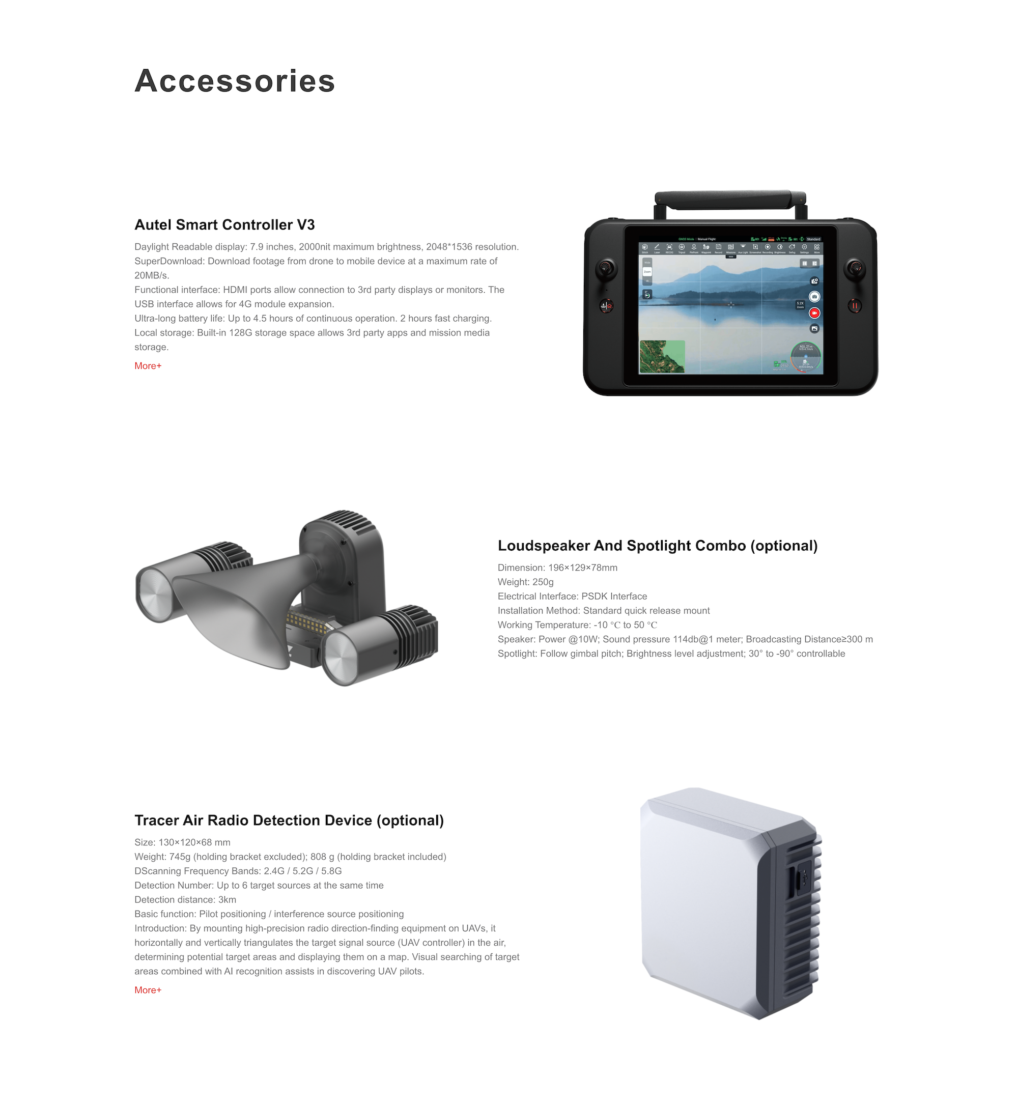
Autel Smart Controller V3 – 7.9″ ultra-bright 2000-nit touchscreen, HDMI out, 128GB storage
Loudspeaker & Spotlight Combo – 114dB speaker, 300m coverage
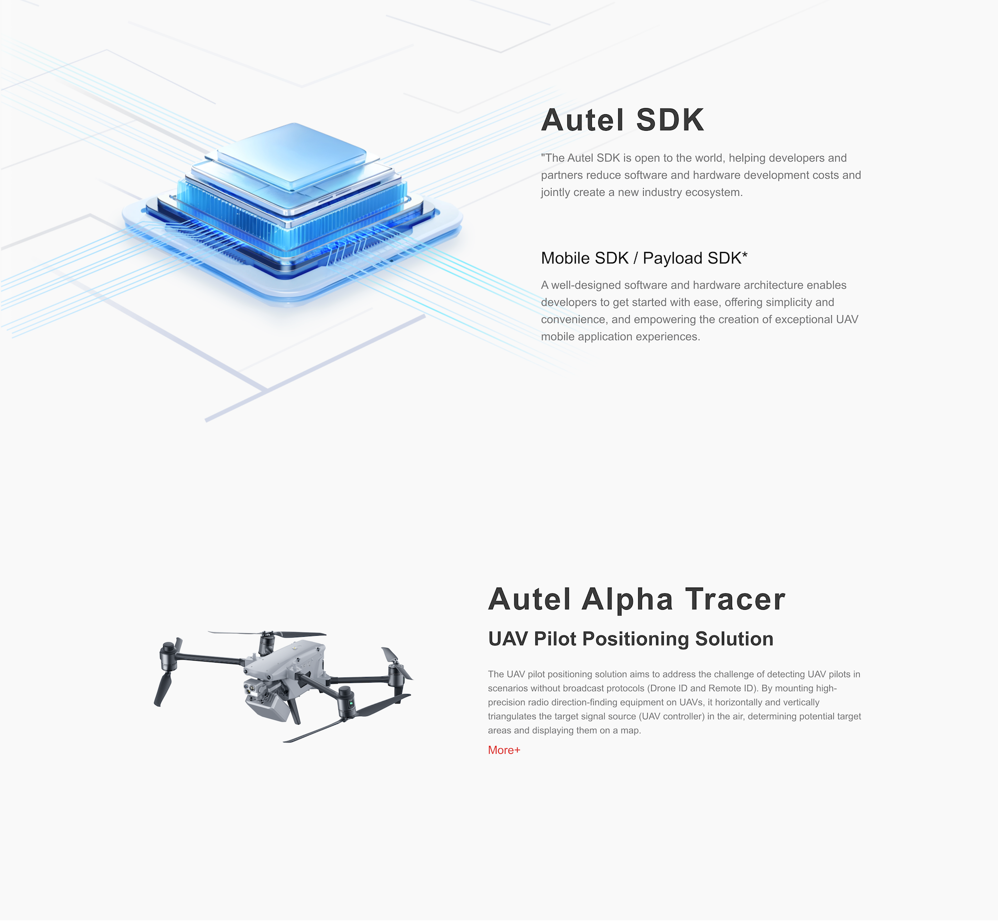
Autel Alpha Tracer – RF-based UAV pilot geolocation system
Payload SDK Integration – for lights, sensors, and custom modules
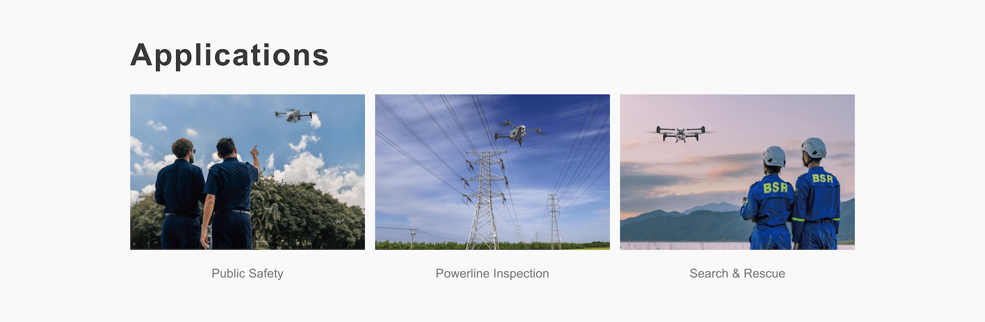
Public Safety & Emergency Response
Powerline & Utility Inspection
Industrial Facility Surveillance
Border Patrol & Infrastructure Mapping
Search & Rescue Missions
The Autel Alpha multirotor drone is built for professionals who require reliability, precision, and adaptability in every mission.
If you have any questions regarding our products, use the Motionew Contact us to consult our engineering team.
1. What is the flight endurance of the M25 VTOL drone?
The M25 offers up to 240 minutes of flight time without payload and around 210 minutes with a 1.2 kg payload, providing exceptional endurance for mapping and surveillance missions.
2. What is the maximum payload capacity and supported equipment?
The drone can carry up to 3 kg of payload, suitable for LiDAR, RGB, multispectral, or thermal sensors depending on the mission profile.
3. Which flight controller and communication systems are supported?
The M25 supports CUAV V5+, CUAV X7+, and Cube Orange flight controllers, along with options for long-range telemetry, digital datalinks, or 4G/5G communication.
4. What payment options are available for purchasing the M25?
MotioNew accepts major international credit/debit cards and bank wire transfers. Corporate clients may also request proforma invoices for bulk purchases.
5. Is OEM customization available for enterprise clients?
Yes. MotioNew provides OEM and customization services, including payload integration, branding, and software configuration for bulk or institutional orders.
6. What documents and support materials are provided?
Each M25 package includes a user manual, technical specification sheet, and maintenance documentation, supported by MotioNew’s after-sales technical team.
The Autel Alpha drone features a maximum take-off mass of 8.4 kg, with a flight speed of up to 15 m/s in Ludicrous mode, making it ideal for high-efficiency missions that require rapid deployment and long-range coverage.
Its robust airframe and IP55-rated weather resistance ensure reliable performance in challenging conditions such as rain, dust, and strong winds, while the advanced obstacle avoidance system and high-precision RTK positioning deliver safe and stable flight even in complex environments.
Combined with its powerful imaging payloads, the Alpha is perfectly suited for applications like powerline inspection, search and rescue, border surveillance, and industrial site monitoring.
| Autel Alpha Empty Weight | 5535 g (Smart battery, propellers included and gimbal excluded) |
| Autel Alpha Weight | 6480 g (Smart battery, gimbal and propellers included) |
| Autel Alpha Maximum Take-Off Mass (MTOM) | 8400 g |
| Fuselage Dimensions | 1205×980×278 mm (unfolded, incl. propellers) 780×568×278 mm(unfolded, excl. propellers) 455×263×248 mm (folded, excl. propellers) |
| Diagonal Wheelbase | Diagonal: 814 mm |
| Maximum Ascent Speed | Slow: 2.5 m/s Smooth: 3 m/s Standard: 6 m/s Ludicrous: 15 m/s |
| Maximum Descent Speed | Slow: 2.5 m/s Smooth: 3 m/s Standard: 5 m/s Ludicrous: 10m/s |
| Maximum Horizontal Flight Speed (Windless Near Sea Level) |
Slow: 3 m/s Smooth: 10 m/s Standard: 15 m/s (forward & backward), 10 m/s (sidewards) Ludicrous: 25 m/s (forward & backward & sidewards) |
| Maximum Service Ceiling Above Sea Level | 4500 meters |
| Maximum Flight Altitude | 800 meters (Altitude limit in the App) |
| Maximum Flight Time (Windless, Speed: 10.5 m/s) |
40 minutes |
| Maximum Range | 30 km (with carbon fiber propeller) 27.5km (with injection molded propeller) |
| Maximum Hovering Time (Windless) | 38 minutes |
| Maximum Wind Speed Resistance | 12 m/s |
| Maximum Tilt Angle | Slow: 10° Smooth: 30° Standard: 30° Ludicrous: 36° |
| Maximum Angular Velocity | Pitch axis: 300°/s Heading axis: 120°/s |
| Operating Temperature | -20℃ to 50℃ |
| Hot-swappable Batteries | Supported |
| IP Rating | IP55 |
| GNSS | GPS+Galileo+BeiDou+GLONASS |
| Hovering Accuracy | Vertically ±0.1 m (when visual positioning works normally) ±0.3 m (when GNSS works normally) ±0.1 m (when RTK FIX) Horizontally ±0.15 m (when visual positioning works normally) ±0.3 m (when GNSS works normally) ±0.1 m (when RTK FIX) |
| Operating Frequency | 900M: 902 – 928 MHz* 2.4G: 2.400 – 2.476GHz**, 2.400 – 2.4835 GHz 5.2G: 5.15 – 5.25 GHz***, 5.17 – 5.25 GHz**** 5.8G: 5.725 – 5.829GHz**, 5.725 – 5.850GHz * Only applicable to FCC and ISED regions. **Only applicable to SRRC regions. *** Only applicable to FCC, CE (except Germany), and UKCA regions. **** Only applicable to Germany. Note: Some frequencies are only available in some regions or for indoor use only. Check local laws and regulations for details. |
| Maximum Transmission Distance (Without Interference and Blocking) |
FCC: 15km CE: 8km |
| Effective Isotropic Radiated Power (EIRP) |
900M: ≤30dBm (FCC/ISED) 2.4G: ≤30dBm(FCC/ISED); ≤20dBm(CE/SRRC/UKCA) 5.2G: ≤30dBm(FCC); ≤23 dBm(CE/UKCA) 5.8G: ≤30dBm (FCC/ISED/SRRC); ≤14dBm (CE/UKCA) |
| Sensing Range | Forward: 0.2 – 31 m Backward: 0.2 – 26 m Sidewards: 0.5 – 45 m Upward: 0.2 – 45 m Downward: 0.2 – 45 m |
| FOV | Forward & Backward: 90°(H), 90°(V) Sidewards: 90°(H), 90°(V) Upward: 90°(H), 90°(V) Downward: 90°(H), 90°(V) |
| Operating Environment | Forward, backward, sidewards, and upward: The surface has rich textures, under a sufficient lighting environment (>15 lux). Downwards: The surface is a diffuse material with a reflectivity >20% (walls, trees, humans, etc.), under a sufficient lighting environment (>15 lux). |
| Operating Frequency | 60G: 60 – 64GHz 24G: 24.0 – 24.25GHz |
| Effective Isotropic Radiated Power (EIRP) |
60G: ≤20dBm (CE/UKCA/FCC) 24G: ≤20mW(SRRC) |
| Sensing Range | 60G radar: Upward: 0.3 – 20 m Downward: 0.15 – 40 m Forward & Backward: 0.3 – 30 m Sidewards: 0.3 – 30 m 24G radar: Downward: 0.8 – 20 m |
| FOV | Horizontal (6dB): ±35°/±22° (60 GHz/24 GHz) Vertical (6dB): ±30°/±20° (60 GHz/24 GHz)) |
| Operating Environment | 60G millimeter-wave radar sensing system: Supports all-weather obstacle avoidance for glass, water, wires, buildings, and trees in 6 directions. Its obstacle avoidance distance varies with the obstacle’s ability to reflect electromagnetic waves and its surface size. 24G millimeter-wave radar sensing system: Supports downward sensing, and its sensing range varies by the ground material. For example, the sensing range of cement ground is 20 meters, and the sensing range of grass with a thickness of more than 3 cm is less than 10 meters. |
| Aircraft Version Limitations* | In order to comply with the regulations of the country or region where the target market is located, aircraft bottom millimeter-wave radars in some markets use the 24G frequency band, and the five directions of front, rear, left, right, and top use the 60G frequency band. Among them, the 24G version of the aircraft has turned off the 60G radar function in the five directions of front, rear, left, right, and top in the flight control software before leaving the factory, and only turned on the bottom 24G radar for assisted landing. The 24G version of the aircraft only supports visual obstacle avoidance under good lighting conditions and does not support the millimeter-wave radar obstacle avoidance function at night. |
| Wi-Fi Protocol | 802.11a/b/g/n/ac/ax |
| Wi-Fi Operating Frequency | 2.4G: 2.400 – 2.476GHz*, 2.400 – 2.4835 GHz 5.2G: 5.15-5.25GHz**, 5.17-5.25GHz*** 5.8G: 5.725 – 5.829GHz*, 5.725 – 5.850 GHz *Only applicable to SRRC regions. ** Only applicable to FCC, CE (except Germany), and UKCA regions. *** Only applicable to Germany. Note: Some frequencies are only available in some regions or for indoor use only. Check local laws and regulations for details. |
| Wi-Fi Transmitter Power (EIRP) | 2.4G: ≤30dBm (FCC/ISED); ≤20dBm (CE/SRRC/UKCA) 5.2G: ≤30dBm (FCC); ≤23dBm (CE/UKCA) 5.8G: ≤30dBm (FCC/ISED/SRRC); ≤14dBm (CE/UKCA) |
| Dimension | 144.7×133.3×158.4 mm |
| Weight | 920g |
| IP Rating | IP55 |
| Installation | Detachable (E-shape design) |
| Operating Temperature | -20℃ to +50℃ |
| Storage Temperature | -30℃ to +70℃ |
| Data Storage | Support microSD |
| Max. Expandable Memory | 256GB |
| Recommended Memory Card List | UHS-I Speed Class U3 or V30, minimum write speed 30MB/s |
| Mechanical Ranger | Pitch: -135° to 45° Roll: -60° to 60° Yaw: -90° to 90° |
| Controllable Range | Pitch: -90° to 30° |
| Stable system | 3-axis mechanical gimbal (pitch, yaw, roll) |
| Max Control Speed (pitch) | 100°/s |
| Angular Vibration Range | <0.005° |
| Image Sensor | 1/1.8″ CMOS. Effective pixels: 8M |
| Lens | Focal length: 7.1 – 171.95 mm±5% 35 mm equivalent focal length: 34.7 – 838 mm Aperture: f/1.61(Wide)- f/5.19(Tele)±5% Focusing distance: 10 m ~ ∞ |
| ISO Range | Normal mode ISO100 – ISO25600 Super Night ISO100 – ISO160000 |
| Shutter Speed | Photo: 0.5s ~ 1/8000s Video: 1/30s ~ 1/8000s |
| Exposure Compensation | ±3.0 (1/3 increments) |
| Digital Zoom | 1.4 – 35x continuous optical zoom, 35-560x digital zoom |
| IR-CUT | Default Setting: Auto – Disabled during daytime, activated during nighttime. Manual Activation: Turn on IR-CUT – Display in Black and White. Manual Deactivation: Turn off IR-CUT – Display in Color. |
| Max Photo Resolution | 3840×2160 |
| Photo Format | JPG |
| Photo Taking Mode | Auto |
| Video Resolution | 3840×2160 30P |
| Video Format | MP4 |
| Max Bit Rate | 30Mbps |
| Supported File Systems | exFAT/Fat32 |
| Image Sensor | 1/2″ CMOS. Effective pixels: 48M |
| Lens | Focal length: 4.49 mm Equivalent focal length: 24 mm Aperture: f/2.8 |
| ISO Range | Auto: ISO100 – ISO3200 |
| Shutter Speed | Photo: 0.5s ~ 1/8000s Video: 1/30s ~ 1/8000s |
| Photo Size | 4000×3000 |
| Photo Format | JPG |
| Photo Taking Mode | Auto |
| Video Resolution | 4000×3000 25P |
| Video Format | MP4 |
| Max Bit Rate | 30Mbps |
| Supported File Systems | exFAT/Fat32 |
| Image Sensor | Uncooled VOx Microbolometer |
| Lens | FOV: 42° Focal length: 13 mm Aperture: f/1.2 Focusing distance: 6 m ~ ∞ |
| Sensitivity | ≤50mK@f/1.0, 25°C |
| Pixel Pitch | 12um |
| Wavelength | 8 – 14um |
| Radiometric Measurement Method | Center measurement/Pot measurement/Rectangular measurement |
| Radiometric Temperature Range | -20°C to 150°C (high gain mode); 0 to 550°C (low gain mode) |
| Radiometric Measurement Accuracy | 5-meter distance test in a windless laboratory environment at 25°C: ±3°C or reading ±3% (using the larger value) @ ambient temperature ranges from -20°C to 60°C |
| Accurate Temperature Measurement Distance | 5 m |
| Digital Zoom | 1-3.5x wide angle digital zoom |
| Temperature Alert | High and low temperature alarm thresholds, Reporting coordinates and temperature values |
| Palette | White Hot/Black Hot/Searing/ Rainbow/Grey/Ironbow/Cold and Hot |
| Photo Size | 640×512 |
| Photo Format | JPG (the images contain temperature information and are parsed by dedicated SDK and PC tools) |
| Photo Taking Mode | Auto |
| Video Resolution | 640×512@25FPS |
| Video Format | MP4 |
| Image Sensor | Uncooled VOx Microbolometer |
| Lens | FOV: 12.3° Focal length: 45 mm Aperture: f/1.2 Focusing distance: 35 m ~ ∞ |
| Sensitivity | ≤50mK@f/1.0, 25°C |
| Pixel Pitch | 12um |
| Wavelength | 8 – 14um |
| Radiometric Measurement Method | Center measurement/Pot measurement/Rectangular measurement |
| Radiometric Temperature Range | -20°C to 150°C (high gain mode); 0 to 550°C (low gain mode) |
| Radiometric Measurement Accuracy | 35-meter distance test in a windless laboratory environment at 25°C: ±5°C or reading ±5% (using the larger value) @ ambient temperature ranges from -20°C to 60°C |
| Accurate Temperature Measurement Distance | 35 m |
| Digital Zoom | 3.5-56x tele digital zoom |
| Temperature Alert | High and low temperature alarm thresholds, Reporting coordinates and temperature values |
| Palette | White Hot/Black Hot/Searing/ Rainbow/Grey/Ironbow/Cold and Hot |
| Photo Size | 640×512 |
| Photo Format | JPG (the images contain temperature information and are parsed by dedicated SDK and PC tools) |
| Photo Taking Mode | Auto |
| Video Resolution | 640×512@25FPS |
| Video Format | MP4 |
| Wavelength | 905 nm |
| Measurement Accuracy | <400m: +1m, >400m: D×0.3% where D is the distance to a vertical reflecting plane |
| Measuring Range | 10 – 2000 m |
| Dimensions | 269×189×87 mm (antennas folded horizontally) 269×189×173 mm (antennas folded vertically) 269×302×87 mm (antennas unfolded horizontally) |
| Weight | 1194 g (protective case excluded) 1365 g (protective case included) |
| Operating Temperature | -20℃ to 40℃ |
| Storage Temperature | +15℃ ~ +25℃ (within a year) 0℃ ~ +30℃ (within three months) -20℃ ~ +45℃ (within a month) |
| Protection Rating | IP43 |
| Internal Storage | 128GB |
| microSD Extension | Not supported |
| Operating System | Based on Android 11 |
| Application Installation | Supports the installation of third-party Android apps |
| Video Performance | 4K@24FPS H.264/H.265 video smooth play |
| HDMI | Outputs up to 1080P@60FPS video |
| USB-C | Charging: supports PD/QC fast charging, up to 65W Data: USB3.1 Gen2 |
| USB-A | Charging: 5V/2A Data: USB2.0 |
| GNSS | GPS+Galileo+BeiDou+GLONASS |
| Wi-Fi Protocol | 802.11a/b/g/n/ac Supports 2×2 MIMO Wi-Fi |
| Wi-Fi Operating Frequency | 2.4G: 2.400–2.476GHz*, 2.400–2.4835GHz 5.8G: 5.725-5.829GHz*, 5.725-5.850GHz *Only applies to SRRC region Note: Some frequencies are only applicable in some regions or only used in door. For details, please refer to local laws and regulations. |
| Wi-Fi Effective Isotropic Radiated Power (EIRP) |
2.4G: ≤30dBm(FCC/ISED); ≤20dBm(CE/SRRC/UKCA) 5.8G: ≤30dBm(FCC/ISED/SRRC); ≤14dBm(CE/UKCA) |
| Bluetooth | Bluetooth 5.0 |
| Bluetooth Operating Frequency | 2.400 – 2.4835 GHz Note: Some regions have designated frequency ranges. Check local laws and regulations for details. |
| Bluetooth Effective Isotropic Radiated Power (EIRP) |
≤20dBm |
| Antenna | Dual antennas, 1T2R, detachable design |
| Operating Frequency | 900M: 902-928MHz* 2.4G: 2.400–2.476GHz**, 2.400–2.4835GHz 5.8G: 5.725-5.829GHz**, 5.725-5.850GHz * Only applicable to FCC and ISED regions. ** Only applicable to SRRC region. Note: Some frequencies are only applicable in some regions or only used in door. For details, please refer to local laws and regulations. |
| Effective Isotropic Radiated Power (EIRP) |
900M: ≤30dBm(FCC/ISED) 2.4G: ≤30dBm(FCC/ISED); ≤20dBm (CE/SRRC/UKCA) 5.8G: ≤30dBm(FCC/ISED/SRRC); ≤14dBm (CE/UKCA) |
| Maximum Transmission Distance (Without Interference and Blocking) |
FCC: 15 km CE/SRRC: 8 km |
| Type | TFT LCD |
| Dimensions | 7.9 inches |
| Maximum Brightness | 2000 nits |
| Resolution | 2048×1536 |
| Refresh Rate | 60Hz |
| Touch Control | Supports 10-point touch |
| Battery Type | Li-Po 3S |
| Rated Capacity | 5800 mAh |
| Voltage | 11.55V |
| Battery Energy | 67 Wh |
| Charging Time | About 120 minutes |
| Battery Endurance | 2.5 hours (Max brightness) 4.0 hours (50% brightness) |
| Battery Replacement | Not supported |
| Battery Dimension | 200×76.8×50 mm |
| Operating Temperature | -20℃ to 50℃ |
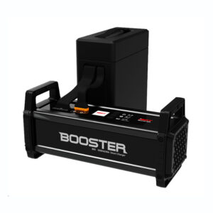
| Battery Type | LiPo 6S |
| Rated Capacity | 10000mAh |
| Battery Energy | 237Wh |
| Voltage | 23.7V |
| Charging Voltage Limit | 26.7V |
| Rated Charging Power | 180W |
| Maximum Charging Power | 260W |
| Weight | 995 g |
| Battery Charge Temperature | +10℃ ~ +40℃* (When the battery temperature is below 10℃, the battery stops charging and activates self-heating. When the battery temperature is above +40℃, the battery stops charging.) |
| Ideal Storage Temperature | +22℃ ~ +28℃ |
| Storage Temperature & Humidity | -10℃ ~ +30℃, 65±20%RH |
You must be logged in to post a review.
| MTOW |
8.4kg |
|---|---|
| Max. Payload |
1.9kg |
| Multirotor Application |
Inspection/Surveillance ,Mapping |
| Multirotor Wheelbase |
814mm |
| Number of motors |
4 |
| Number of arms |
4 |
| Airframe Weight |
5.5kg |
| Foldable Airframe |
YES |
| Multirotor Type |
Electric |
No account yet?
Create an Account

Reviews
Clear filtersThere are no reviews yet.